MyTopo
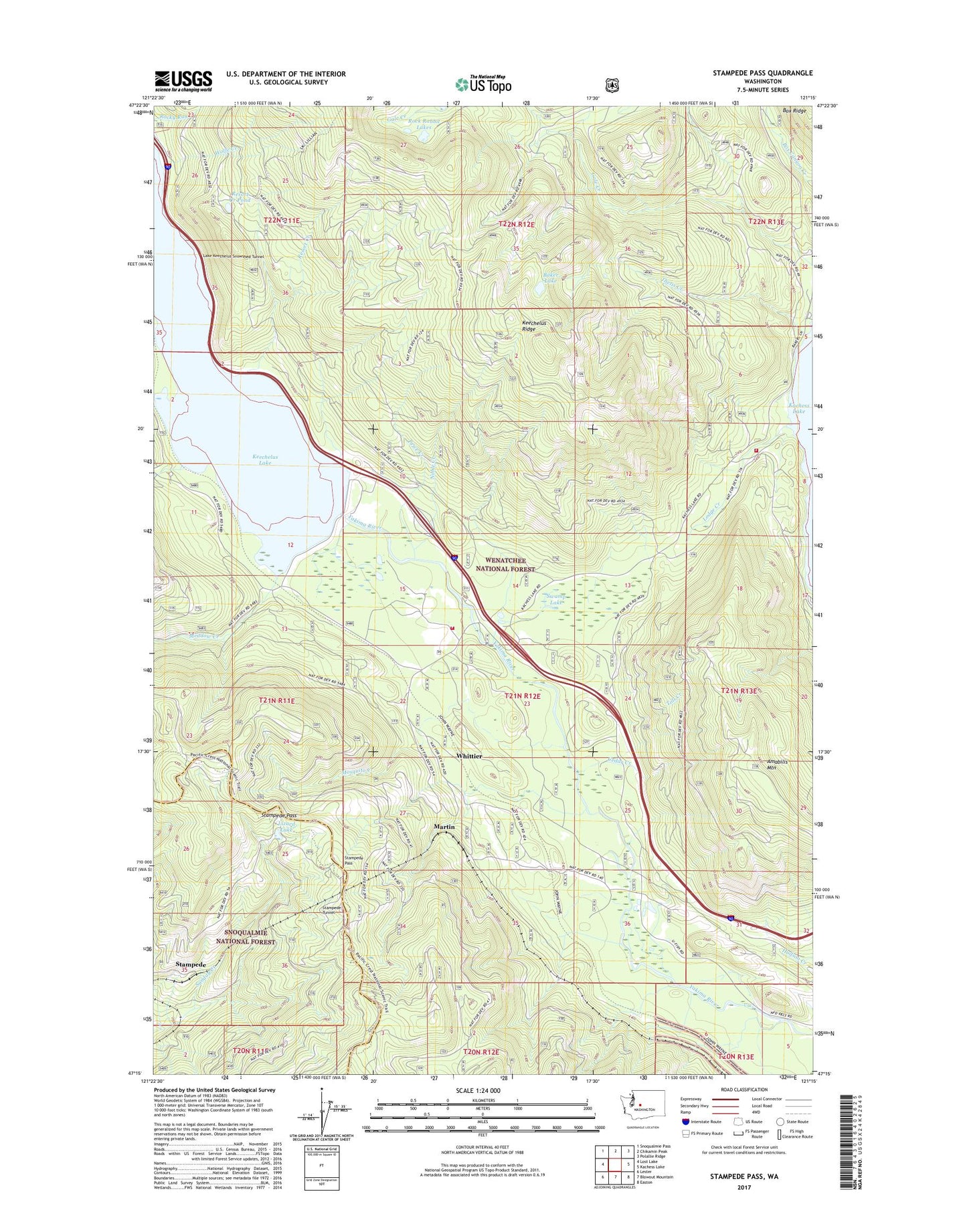
Stampede Pass Washington US Topo Map
Couldn't load pickup availability
Also explore the Stampede Pass Forest Service Topo of this same quad for updated USFS data
2023 topographic map quadrangle Stampede Pass in the state of Washington. Scale: 1:24000. Based on the newly updated USGS 7.5' US Topo map series, this map is in the following counties: Kittitas, King. The map contains contour data, water features, and other items you are used to seeing on USGS maps, but also has updated roads and other features. This is the next generation of topographic maps. Printed on high-quality waterproof paper with UV fade-resistant inks.
Quads adjacent to this one:
West: Lost Lake
Northwest: Snoqualmie Pass
North: Chikamin Peak
Northeast: Polallie Ridge
East: Kachess Lake
Southeast: Easton
South: Blowout Mountain
Southwest: Lester
This map covers the same area as the classic USGS quad with code o47121c3.
Contains the following named places: Amabilis Mountain, Baker Lake, Bakers Camp, Cabin Creek Sno-Park, Cedar Creek, Crystal Springs Campground, Houle Creek, Kachess Guard Station, Kachess Resort, Kachess Sno-Park, Keechelus, Keechelus Dam, Keechelus Lake, Keechelus Ridge, Kittitas County Fire District 8 Station 82, Kittitas County Fire District 8 Station 83, Lake Keechelus Snowshed Tunnel, Lizard Lake, Lodge Creek, Martin, Meadow Creek, Mosquito Creek, Noble Creek, Price Creek, Resort Creek, Resort Creek Pond, Roaring Creek, Rock Rabbit Lakes, Rocky Run Guard Station, Stampede, Stampede Pass, Stampede Tunnel, Swamp Lake, Telephone Creek, Thetis Creek, Toll Creek, Whittier, Wolfe Creek, ZIP Code: 98925