MyTopo
Davis Peak Washington US Topo Map
Couldn't load pickup availability
Also explore the Davis Peak Forest Service Topo of this same quad for updated USFS data
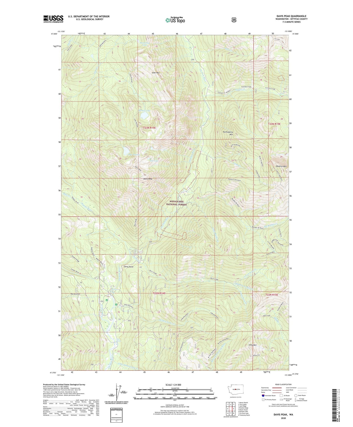
2023 topographic map quadrangle Davis Peak in the state of Washington. Scale: 1:24000. Based on the newly updated USGS 7.5' US Topo map series, this map is in the following counties: Kittitas. The map contains contour data, water features, and other items you are used to seeing on USGS maps, but also has updated roads and other features. This is the next generation of topographic maps. Printed on high-quality waterproof paper with UV fade-resistant inks.
Quads adjacent to this one:
West: Polallie Ridge
Northwest: Mount Daniel
North: The Cradle
Northeast: Jack Ridge
East: Mount Stuart
Southeast: Teanaway Butte
South: Cle Elum Lake
Southwest: Kachess Lake
This map covers the same area as the classic USGS quad with code o47121d1.
Contains the following named places: Big Boulder Creek, Camp Creek, Cayuse Campground, China Point, Cooper River, Davis Peak, Davis Peak Lookout, Davis Peak Lookout Trail, Elsnor Mine, Fortune Creek, Goat Mountain, Hawkins Mountain, Hour Creek, Hour Creek Campground, Huckleberry Mountain, Jolly Mountain, Jolly Mountain Lookout, Jolly Mountain Lookout Trail, Lake Michael Trail, Lake Terence, Little Boulder Creek, Little Salmon la Sac, Little Salmon la Sac Creek, Michael Lake, Middle Fork Paris Creek, Moonshine Lake, North Fork Paris Creek, Opal Lake, Paris Creek, Red Mountain Trail, Salmon la Sac, Salmon La Sac, Salmon la Sac Campground, Salmon la Sac Creek, Salmon la Sac Forest Service Station, Silver Creek, South Fork Fortune Creek, South Fork Paris Creek, Waptus River, ZIP Code: 98940