MyTopo
Ronald Washington US Topo Map
Couldn't load pickup availability
Also explore the Ronald Forest Service Topo of this same quad for updated USFS data
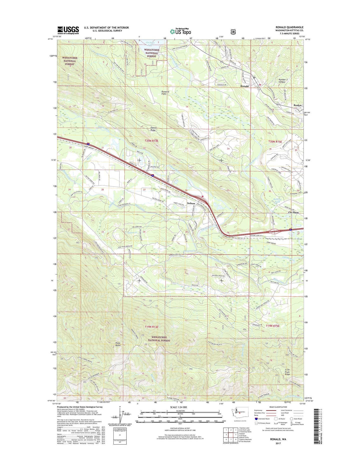
2023 topographic map quadrangle Ronald in the state of Washington. Scale: 1:24000. Based on the newly updated USGS 7.5' US Topo map series, this map is in the following counties: Kittitas. The map contains contour data, water features, and other items you are used to seeing on USGS maps, but also has updated roads and other features. This is the next generation of topographic maps. Printed on high-quality waterproof paper with UV fade-resistant inks.
Quads adjacent to this one:
West: Easton
Northwest: Kachess Lake
North: Cle Elum Lake
Northeast: Teanaway Butte
East: Cle Elum
Southeast: Frost Mountain
South: Quartz Mountain
Southwest: Mount Clifty
This map covers the same area as the classic USGS quad with code o47121b1.
Contains the following named places: Big Creek, Bullfrog Pond, Butte Creek, Cle Elum Dam, Domerie Creek, Domerie Flats, Easton Ridge Lookout, Hicks Butte, Hicks Butte Trail, Kittitas County Fire District 7 Station 73, Kittitas County Fire Protection District 6 Station 61, Lavender, Little Creek, Nelson, Nelson Creek, Number 3 Canyon, Peterson Creek, Ronald, Ronald Census Designated Place, Ronald Post Office, Roslyn Cascade Mine 4, South Cle Elum Ridge, Spex Arth Creek