MyTopo
Kamilche Valley Washington US Topo Map
Couldn't load pickup availability
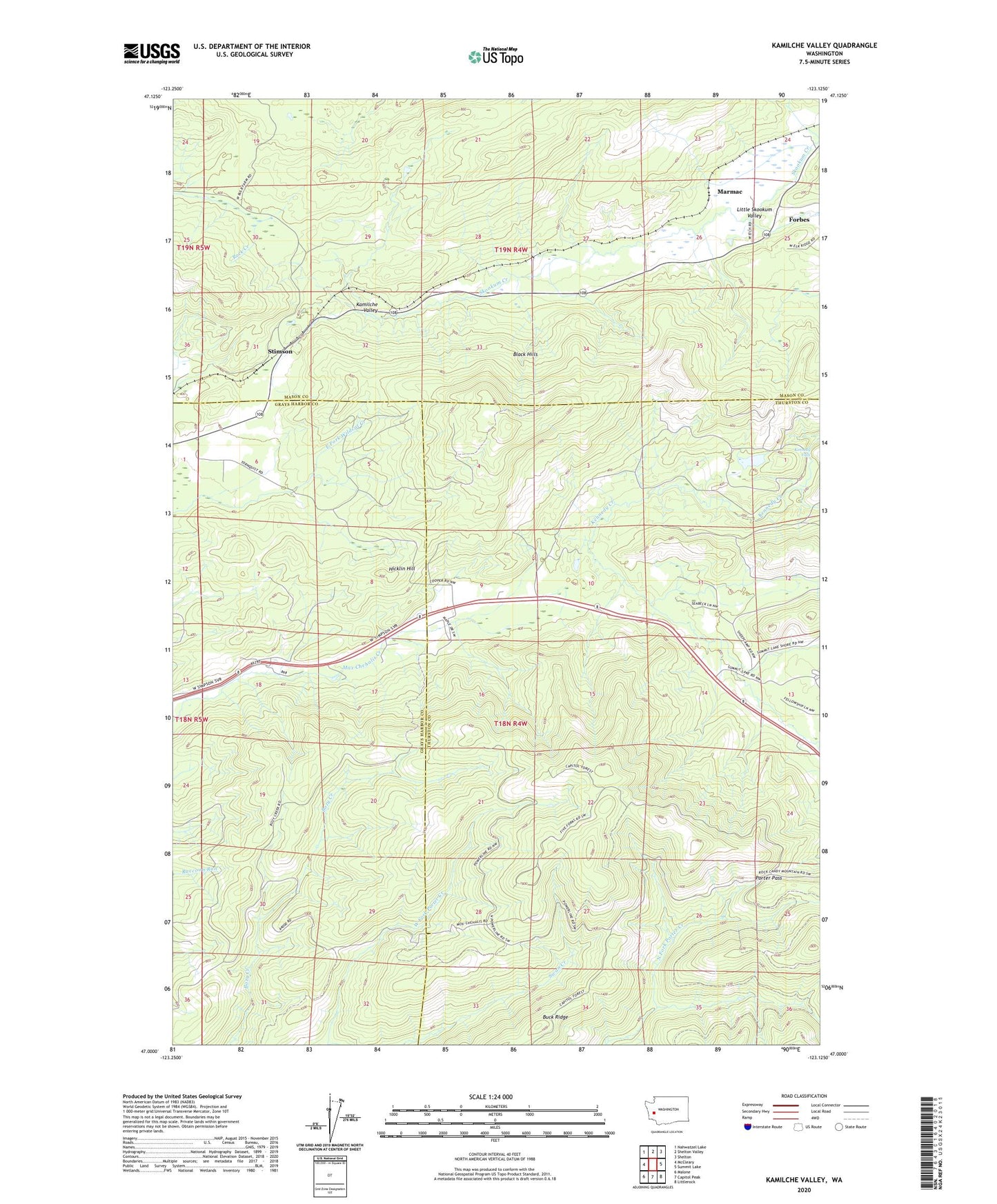
2020 topographic map quadrangle Kamilche Valley in the state of Washington. Scale: 1:24000. Based on the newly updated USGS 7.5' US Topo map series, this map is in the following counties: Thurston, Mason, Grays Harbor. The map contains contour data, water features, and other items you are used to seeing on USGS maps, but also has updated roads and other features. This is the next generation of topographic maps. Printed on high-quality waterproof paper with UV fade-resistant inks.
Quads adjacent to this one:
West: McCleary
Northwest: Nahwatzel Lake
North: Shelton Valley
Northeast: Shelton
East: Summit Lake
Southeast: Littlerock
South: Capitol Peak
Southwest: Malone
Contains the following named places: Aband School, Forbes, Hicklin Hill, Kamilche Division, Kennedy Falls, Little Skookum Valley, Marmac, Mox Chuck Truck Trail, Porter Pass, Stimson