MyTopo
Summit Lake Washington US Topo Map
Couldn't load pickup availability
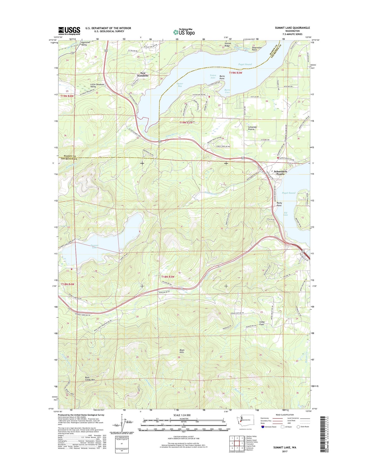
2023 topographic map quadrangle Summit Lake in the state of Washington. Scale: 1:24000. Based on the newly updated USGS 7.5' US Topo map series, this map is in the following counties: Thurston, Mason. The map contains contour data, water features, and other items you are used to seeing on USGS maps, but also has updated roads and other features. This is the next generation of topographic maps. Printed on high-quality waterproof paper with UV fade-resistant inks.
Quads adjacent to this one:
West: Kamilche Valley
Northwest: Shelton Valley
North: Shelton
Northeast: Squaxin Island
East: Tumwater
Southeast: Maytown
South: Littlerock
Southwest: Capitol Peak
This map covers the same area as the classic USGS quad with code o47123a1.
Contains the following named places: Bowman Cove, Burns Cove, Burns Point, Cedar Flats, Deepwater Point, Forest Shores, Griffin Elementary School, Griggs Creek, Hurley cove, Kamilche Valley, Kennedy Creek, Madrona Beach, McLane / Black Lake Fire Department Station 93, New Kamilche, Olympia West Division, Oyster Bay, Perry Creek, Rock Candy Mountain, Rocky Point, Schneider Creek, Schneider Prairie, Schneiders Prairie, Slocum Ridge, Snodgrass Creek, Summit Lake, Summit Lake Dam, Swift Creek, Thurston County Fire District 13 Griffin Fire Department Station 13 - 1 Headquarters, Thurston County Fire District 13 Griffin Fire Department Station 13 - 4, ZIP Code: 98502