MyTopo
Shelton Valley Washington US Topo Map
Couldn't load pickup availability
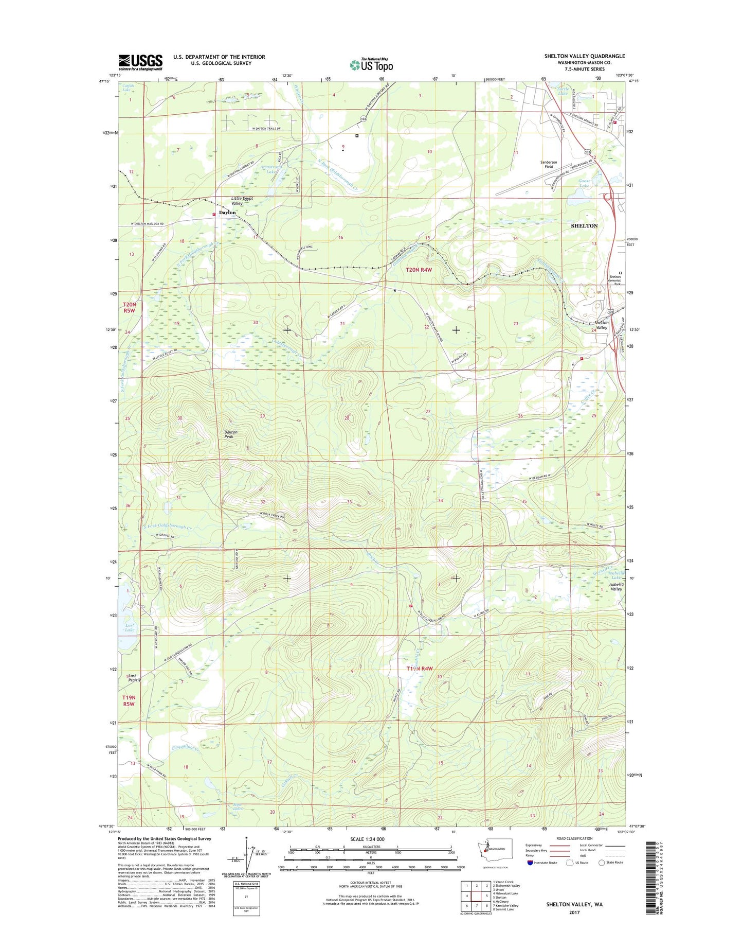
2023 topographic map quadrangle Shelton Valley in the state of Washington. Scale: 1:24000. Based on the newly updated USGS 7.5' US Topo map series, this map is in the following counties: Mason. The map contains contour data, water features, and other items you are used to seeing on USGS maps, but also has updated roads and other features. This is the next generation of topographic maps. Printed on high-quality waterproof paper with UV fade-resistant inks.
Quads adjacent to this one:
West: Nahwatzel Lake
Northwest: Vance Creek
North: Skokomish Valley
Northeast: Union
East: Shelton
Southeast: Summit Lake
South: Kamilche Valley
Southwest: McCleary
This map covers the same area as the classic USGS quad with code o47123b2.
Contains the following named places: Armstrong Lake, Dayton, Dayton Peak, Evergreen Mobile Estates, Goose Lake, Gosnell Creek, Hidden Haven Mobile Home Park, Isabella Valley, Kingdom Hall of Jehovahs Witnesses, Little Egypt Valley, Lost Lake, Lost Prairie, Mason County Fire District 11, Mason County Fire District 13, Mason County Fire District 16 Station 16 - 1, Mason County Fire District 16 Station 16 - 2, Mud Lakes, Naval Auxiliary Air Station Shelton, North Fork Goldsborough Creek, Northside Baptist Church, Rock Creek, Sanderson Field, Shelton Church of the Nazarene, Shelton Presbyterian Church, Shelton Seventh Day Adventist Church, Shelton Valley, Shelton Valley Christian School, South Fork Goldsborough Creek, Spring Road Chapel Church of God, Uddenberg Dam, Washington Corrections Center, Washington Corrections Center Wastewater Treatment Plant, Winter Creek, ZIP Code: 98584