MyTopo
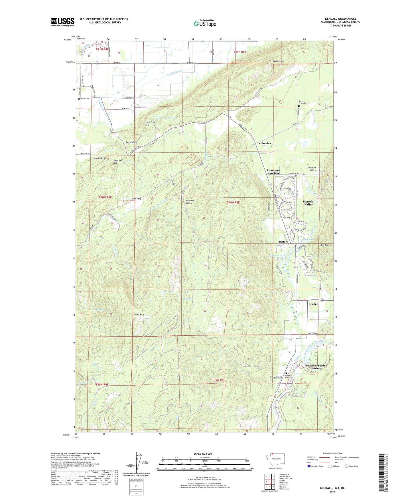
Kendall Washington US Topo Map
Couldn't load pickup availability
2023 topographic map quadrangle Kendall in the state of Washington. Scale: 1:24000. Based on the newly updated USGS 7.5' US Topo map series, this map is in the following counties: Whatcom. The map contains contour data, water features, and other items you are used to seeing on USGS maps, but also has updated roads and other features. This is the next generation of topographic maps. Printed on high-quality waterproof paper with UV fade-resistant inks.
Quads adjacent to this one:
West: Sumas
Northwest: Sumas OE N
North: Kendall OE N
Northeast: Maple Falls OE N
East: Maple Falls
Southeast: Canyon Lake
South: Deming
Southwest: Lawrence
This map covers the same area as the classic USGS quad with code o48122h2.
Contains the following named places: Anderson Lake, Balford, Circle S Farms, Coal Creek, Collins Creek, Columbia, Columbia Valley, El Pam Farms, Green Meadows Dairy, Haystack Hill, Hilltop, Hillview Dairy, Johnson Creek, Kendall, Kendall Cemetery, Kendall Census Designated Place, Kendall Creek, Kendall Elementary School, Kendall Lake, Killum Quarry, Limestone Junction, Lone Tree Hill, Lost Lake, Nooksack Salmon Hatchery, Paradise Valley, Peaceful Valley, Peaceful Valley Census Designated Place, Racehorse Creek, Reese Hill, Saint Peter Catholic Church, Saint Peters Cemetery, Silvergate Dairy, South Pass, Sprague Lake, Sugarloaf Hill, Sumas Cemetery, Sumas Mountain, Sumas Mountain Dairy, Vedder Mountain, Viacres Dairy, Whatcom County Fire District 14 Station 92 Kendell, Whatcom County Water District 13 Sewage Treatment Plant, ZIP Code: 98295