MyTopo
Lawrence Washington US Topo Map
Couldn't load pickup availability
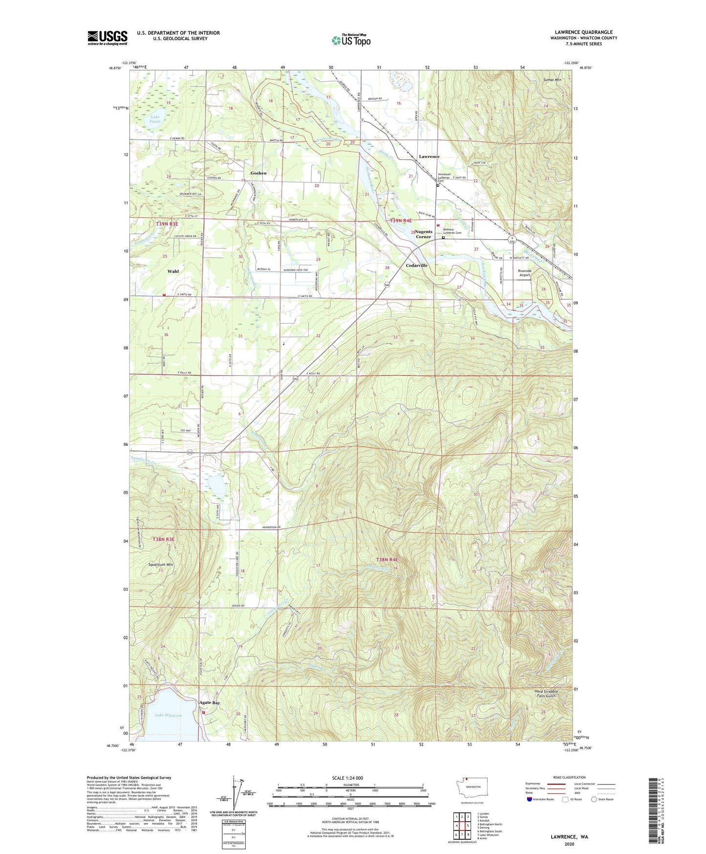
2023 topographic map quadrangle Lawrence in the state of Washington. Scale: 1:24000. Based on the newly updated USGS 7.5' US Topo map series, this map is in the following counties: Whatcom. The map contains contour data, water features, and other items you are used to seeing on USGS maps, but also has updated roads and other features. This is the next generation of topographic maps. Printed on high-quality waterproof paper with UV fade-resistant inks.
Quads adjacent to this one:
West: Bellingham North
Northwest: Lynden
North: Sumas
Northeast: Kendall
East: Deming
Southeast: Acme
South: Lake Whatcom
Southwest: Bellingham South
This map covers the same area as the classic USGS quad with code o48122g3.
Contains the following named places: Agate Bay, Anderson Creek, Bengen Quarry, Bethany Chapel, Bethany Lutheran Cemetery, Carpenter Creek, Cedarville, Goodwin Quarry, Goshen, Goshen Community Church, Harmony Elementary School, Hilltop Woodwaste Landfill, Hoines Farms, Immanuel Lutheran Cemetery, Immanuel Lutheran Church, Immanuel Lutheran Preschool, J M Dairy, Lake Fazon, Lake Whatcom Residential and Treatment Center, Lawrence, Macaulay Creek, Nugents Corner, Olsen Creek, Riverside Airport, Rome Community Bible Church, Sand Road Dairy Farm, Scheenstra Dairy, Smith Creek, Springcrest Farm, Squalicum Lake, Squalicum Mountain, Stewart Mountain, Timber Ridge Center, Wahl, Whatcom County Fire District 1 Station 82, Whatcom County Fire District 4 Station 11 - Agate Bay, Whatcom County Fire District 4 Station 13