MyTopo
Kooskooskie Washington US Topo Map
Couldn't load pickup availability
Also explore the Kooskooskie Forest Service Topo of this same quad for updated USFS data
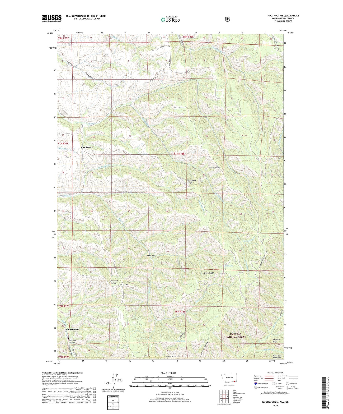
2023 topographic map quadrangle Kooskooskie in the states of Washington, Oregon. Scale: 1:24000. Based on the newly updated USGS 7.5' US Topo map series, this map is in the following counties: Walla Walla, Umatilla. The map contains contour data, water features, and other items you are used to seeing on USGS maps, but also has updated roads and other features. This is the next generation of topographic maps. Printed on high-quality waterproof paper with UV fade-resistant inks.
Quads adjacent to this one:
West: Buroker
Northwest: Dixie
North: Coppei
Northeast: Robinette Mountain
East: Deadman Peak
Southeast: Bone Spring
South: Big Meadows
Southwest: Peterson Ridge
This map covers the same area as the classic USGS quad with code o46118a1.
Contains the following named places: Biscuit Ridge, Blacksnake Ridge, Cold Spring, Five Points, Green Ridge, Kiwanis Camp, Klicker Mountain, Kooskooskie, Laird Gulch, Little Blue Creek, North Fork Dry Creek, Paradise Creek, Railroad Canyon, Sheep Spring, South Fork Dry Creek, Stewart Cabin