MyTopo
Buroker Washington US Topo Map
Couldn't load pickup availability
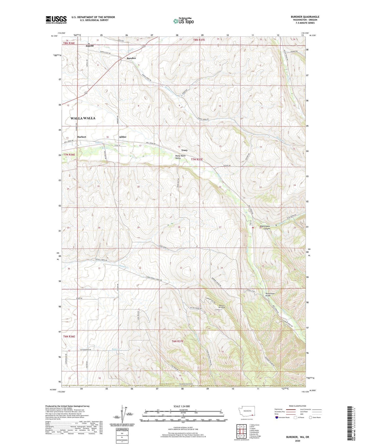
2023 topographic map quadrangle Buroker in the state of Washington. Scale: 1:24000. Based on the newly updated USGS 7.5' US Topo map series, this map is in the following counties: Walla Walla, Umatilla. The map contains contour data, water features, and other items you are used to seeing on USGS maps, but also has updated roads and other features. This is the next generation of topographic maps. Printed on high-quality waterproof paper with UV fade-resistant inks.
Quads adjacent to this one:
West: Walla Walla
Northwest: Valley Grove
North: Dixie
Northeast: Coppei
East: Kooskooskie
Southeast: Big Meadows
South: Peterson Ridge
Southwest: Bowlus Hill
This map covers the same area as the classic USGS quad with code o46118a2.
Contains the following named places: Blue Creek, Buroker, Darcy's Air Strip, Harbert, Kibler, Nightingale Canyon, Sapolil, Spring Creek, Thomas, Tracy, Walla Walla County Fire District 4 Station 45, Wickersham Bridge