MyTopo
Lester Washington US Topo Map
Couldn't load pickup availability
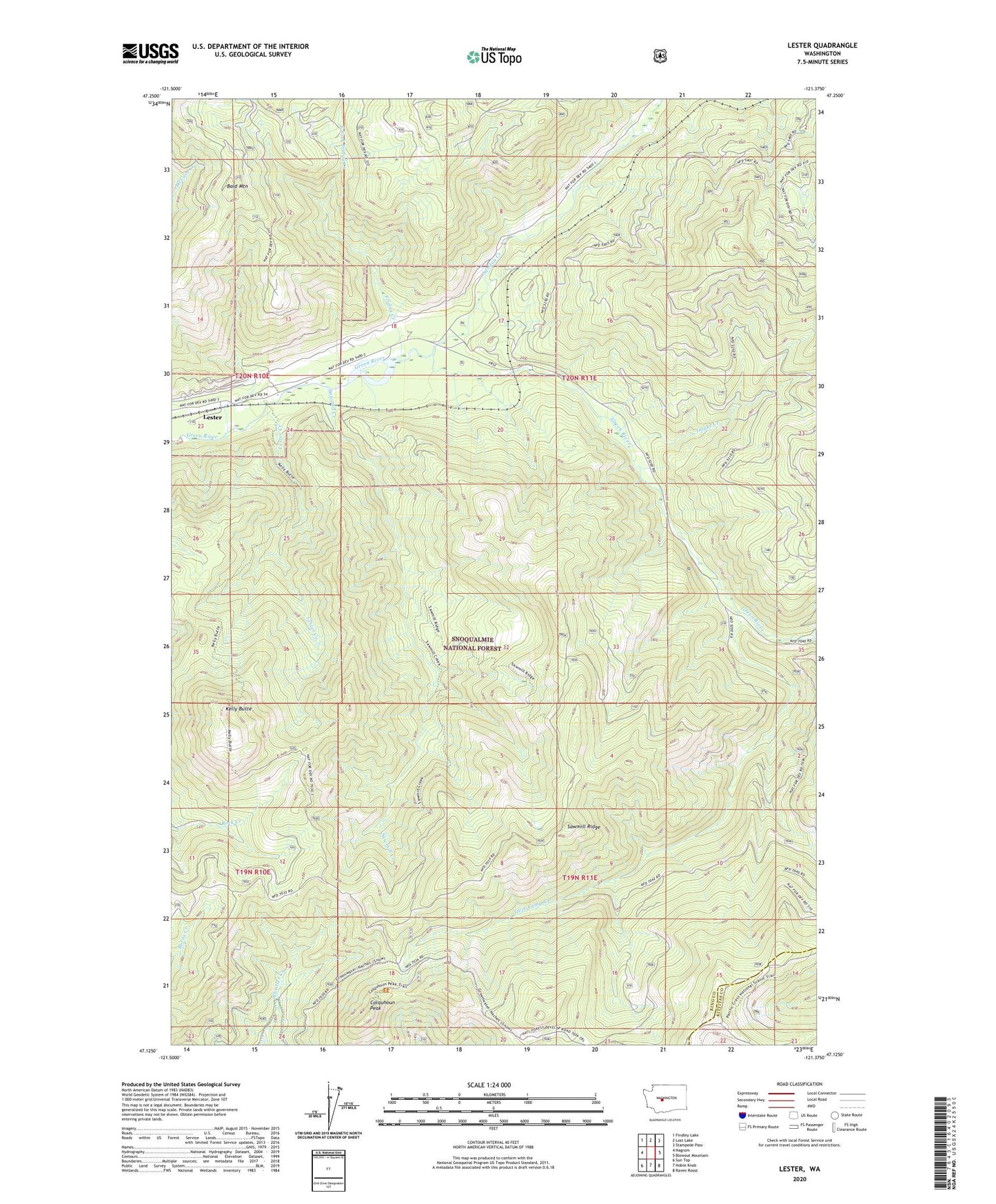
2020 topographic map quadrangle Lester in the state of Washington. Scale: 1:24000. Based on the newly updated USGS 7.5' US Topo map series, this map is in the following counties: King, Kittitas. The map contains contour data, water features, and other items you are used to seeing on USGS maps, but also has updated roads and other features. This is the next generation of topographic maps. Printed on high-quality waterproof paper with UV fade-resistant inks.
Quads adjacent to this one:
West: Nagrom
Northwest: Findley Lake
North: Lost Lake
Northeast: Stampede Pass
East: Blowout Mountain
Southeast: Raven Roost
South: Noble Knob
Southwest: Sun Top
Contains the following named places: Bald Mountain, Colquhoun Peak, Colquhoun Peak Lookout, East Fork Friday Creek, Friday Creek, Green River Watershed, Intake Creek, Kelly Butte, Kelly Butte Lookout, Kelly Butte Trail, Kennedy, Lester, Lester Creek, Lester State Airport, Naches Ranger District, Sawmill Creek, Sawmill Ridge, Sawmill Ridge Trail, Snoqualmie National Forest, Snowshoe Butte Trail, Sunday Creek, Tacoma Creek, Twin Camp, Twin Camp Creek, Twin Camp Recreation Area