
MyTopo
Liberty Lake Washington US Topo Map
Couldn't load pickup availability
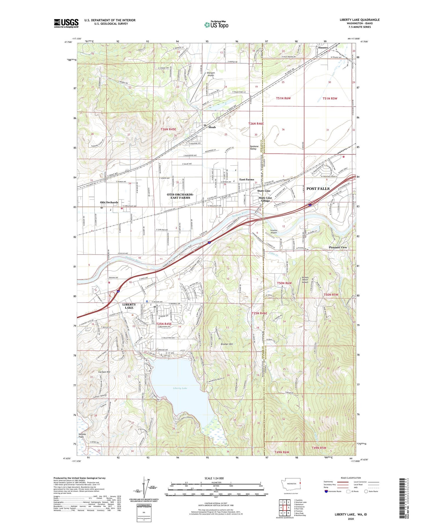
2020 topographic map quadrangle Liberty Lake in the states of Washington, Idaho. Scale: 1:24000. Based on the newly updated USGS 7.5' US Topo map series, this map is in the following counties: Spokane, Kootenai. The map contains contour data, water features, and other items you are used to seeing on USGS maps, but also has updated roads and other features. This is the next generation of topographic maps. Printed on high-quality waterproof paper with UV fade-resistant inks.
Quads adjacent to this one:
West: Greenacres
Northwest: Foothills
North: Newman Lake
Northeast: Rathdrum
East: Post Falls
Southeast: Rockford Bay
South: Mica Peak
Southwest: Freeman
Contains the following named places: Arturdee, Aturdee, Cable Creek, Carlson Hill, City of Liberty Lake, City of State Line, East Farms, East Farms Elementary School, Ellerport Airport, Harvard Park, Hauser, Horse Slaughter Camp, Interstate, Kootenai County Fire and Rescue Station 2, Kramer Hill, Liberty Creek, Liberty Lake, Liberty Lake Division, Liberty Lake Police Department, Liberty Lake Post Office, Moab, Mountain View Middle School, Mulsh Grove, Ne'sliqhwum, Ne'sqhwaqhwe, Newman Lake Post Office, Nichols Ranch Airport, Ni'washalqs Spur, Otis Orchards, Otis Orchards Elementary School, Otis Orchards Post Office, Otis Orchards-East Farms Census Designated Place, Pleasant View, Richards Dam, Scanlon Airport, Skalan Creek, South Branch Canal, Spokane Bridge, Spokane Valley Fire Department Station 3 Liberty Lake, Spokane Valley Fire Department Station 4 Otis Orchards, State Line Village, Valley View Golf Course, Yuts'mn Flat, ZIP Code: 99019


