MyTopo
Freeman Washington US Topo Map
Couldn't load pickup availability
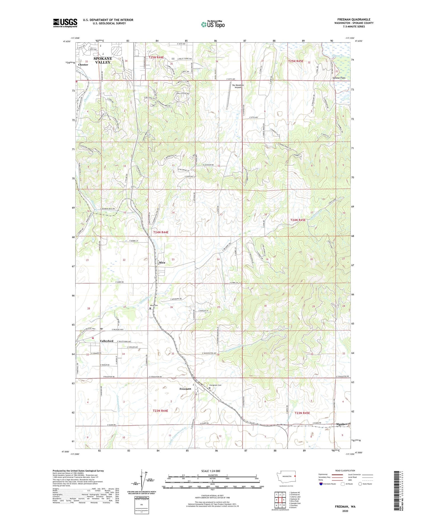
2023 topographic map quadrangle Freeman in the state of Washington. Scale: 1:24000. Based on the newly updated USGS 7.5' US Topo map series, this map is in the following counties: Spokane. The map contains contour data, water features, and other items you are used to seeing on USGS maps, but also has updated roads and other features. This is the next generation of topographic maps. Printed on high-quality waterproof paper with UV fade-resistant inks.
Quads adjacent to this one:
West: Spokane SE
Northwest: Spokane NE
North: Greenacres
Northeast: Liberty Lake
East: Mica Peak
Southeast: Setters
South: Fairfield
Southwest: Spangle East
This map covers the same area as the classic USGS quad with code o47117e2.
Contains the following named places: Chester Elementary School, Deruwe Dam, Evergreen Cemetery, Freeman, Freeman Elementary School, Freeman High School, Horizon Middle School, KSVY-AM (Opportunity), Lockwood, Manito, Mica, Mica Cemetery, Morrow Park, Sky Meadows Airpark, Spokane County Fire District 8 Station 82, Spokane County Fire District 8 Station 84, Valleyford, Valleyford Division, Vallyford Post Office, ZIP Code: 99023