MyTopo
Lost Peak Washington US Topo Map
Couldn't load pickup availability
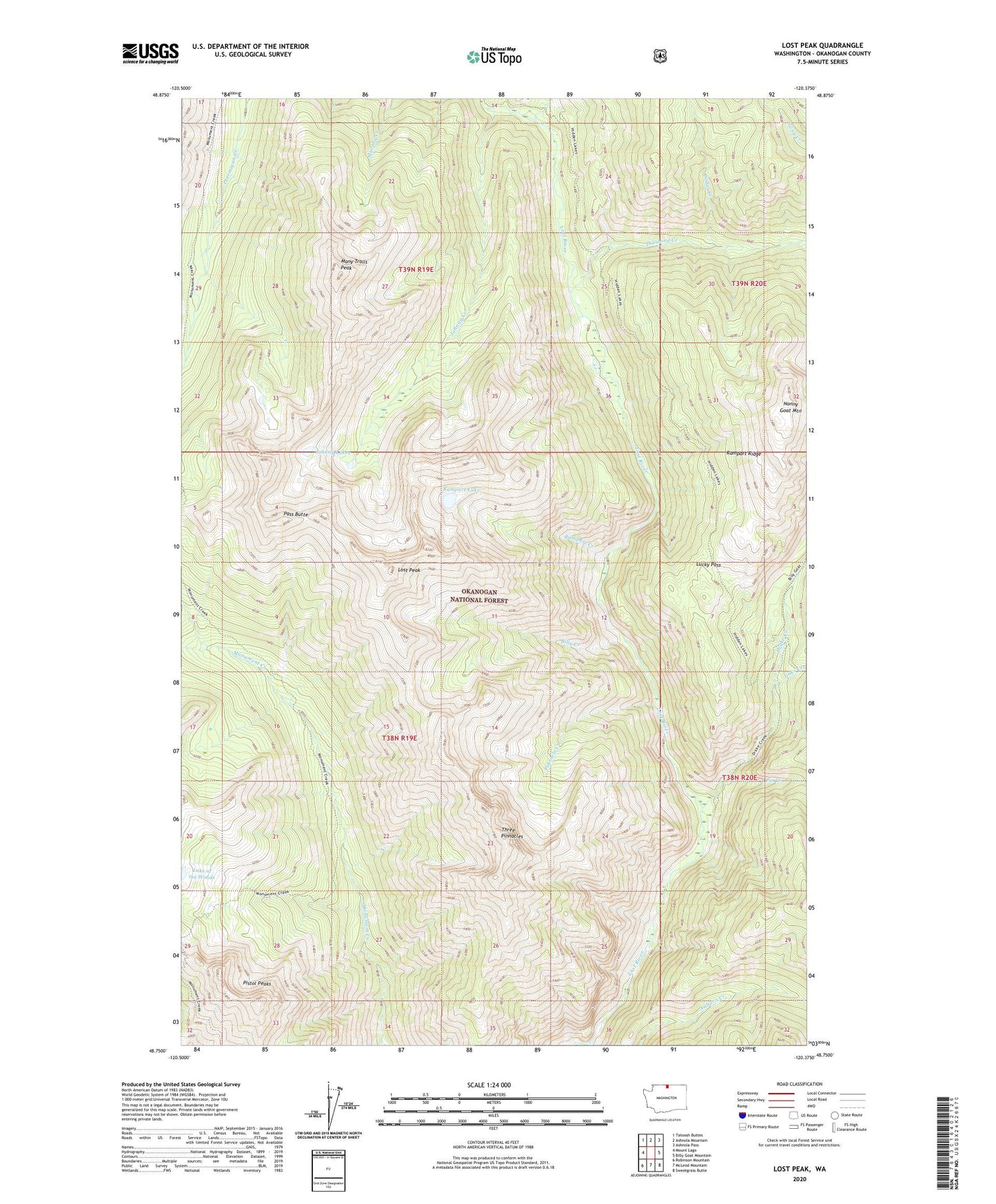
2020 topographic map quadrangle Lost Peak in the state of Washington. Scale: 1:24000. Based on the newly updated USGS 7.5' US Topo map series, this map is in the following counties: Okanogan. The map contains contour data, water features, and other items you are used to seeing on USGS maps, but also has updated roads and other features. This is the next generation of topographic maps. Printed on high-quality waterproof paper with UV fade-resistant inks.
Quads adjacent to this one:
West: Mount Lago
Northwest: Tatoosh Buttes
North: Ashnola Mountain
Northeast: Ashnola Pass
East: Billy Goat Mountain
Southeast: Sweetgrass Butte
South: McLeod Mountain
Southwest: Robinson Mountain
Contains the following named places: Billy Creek, Clints Cabin, Deception Creek, Diamond Creek, Dollar Creek, Dot Creek, Drake Creek, Hoot Owl Camp, Jinks Creek, Johnny Creek, Johnny Lakes, Lake of the Woods, Lost Peak, Lucky Pass, Many Trails Peak, Monument Creek, Nanny Goat Mountain, Pasayten Wilderness, Pass Butte, Pat Creek, Pinnacle Creek, Pistol Pass, Pistol Peaks, Rampart Creek, Rampart Lake, Rampart Ridge, Three Pinnacles