MyTopo
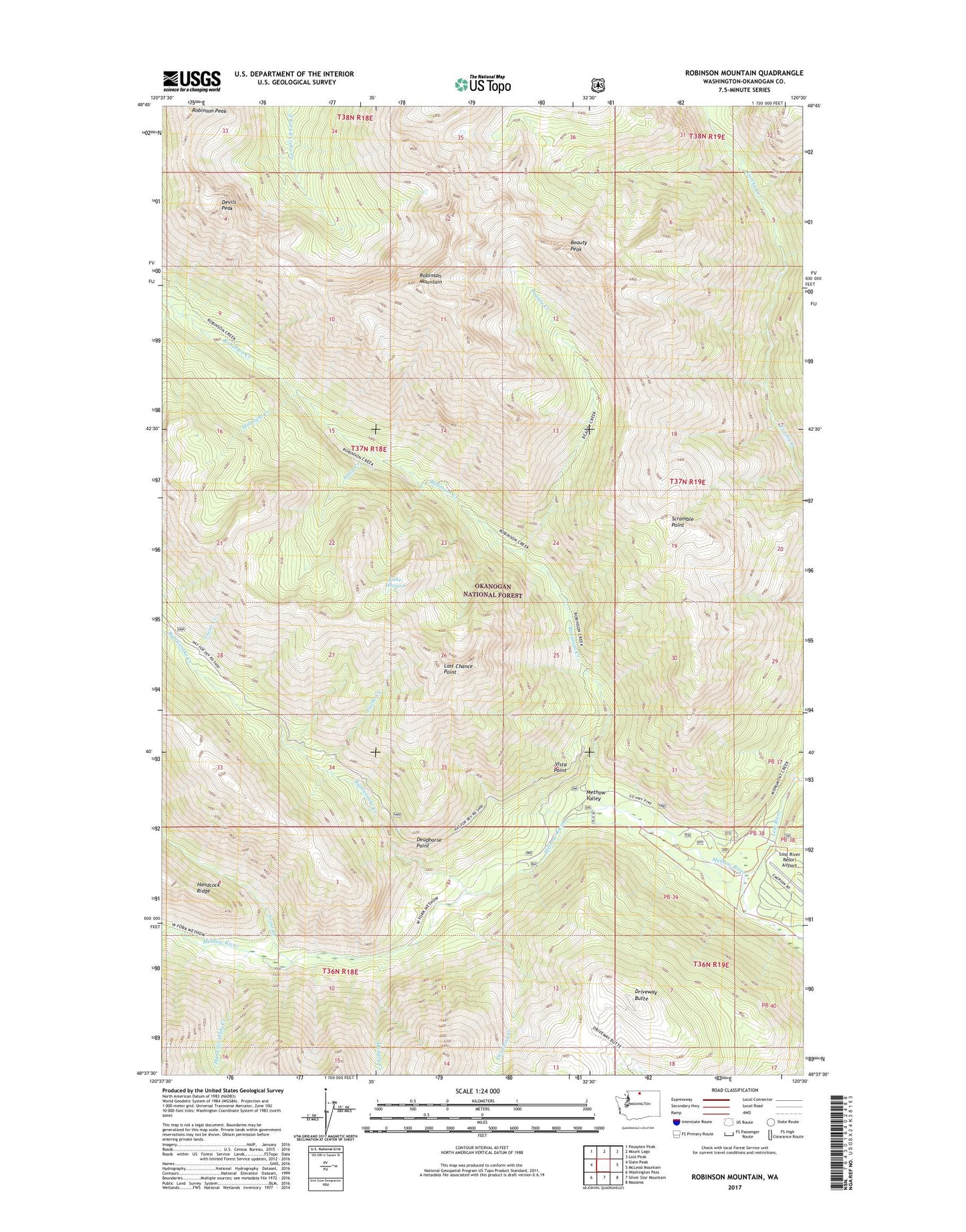
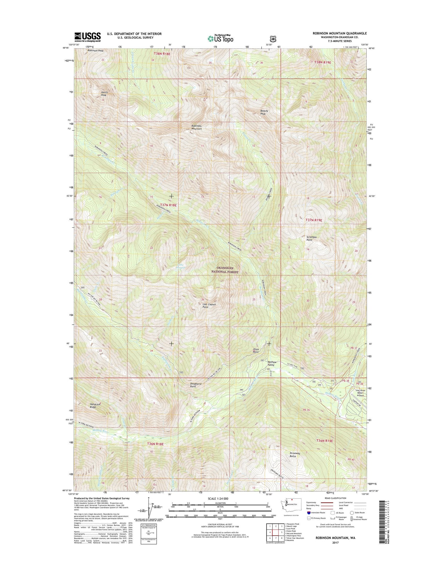
Robinson Mountain Washington US Topo Map
Couldn't load pickup availability
Also explore the Robinson Mountain Forest Service Topo of this same quad for updated USFS data
2023 topographic map quadrangle Robinson Mountain in the state of Washington. Scale: 1:24000. Based on the newly updated USGS 7.5' US Topo map series, this map is in the following counties: Okanogan. The map contains contour data, water features, and other items you are used to seeing on USGS maps, but also has updated roads and other features. This is the next generation of topographic maps. Printed on high-quality waterproof paper with UV fade-resistant inks.
Quads adjacent to this one:
West: Slate Peak
Northwest: Pasayten Peak
North: Mount Lago
Northeast: Lost Peak
East: McLeod Mountain
Southeast: Mazama
South: Silver Star Mountain
Southwest: Washington Pass
This map covers the same area as the classic USGS quad with code o48120f5.
Contains the following named places: Amey Creek, Ballard Campground, Beauty Creek, Beauty Peak, Cache Creek, Deadhorse Point, Devils Peak, Driveway Butte, Driveway Creek, Hard Scrabble Creek, Hardscrabble Creek, Hungry Creek, Lake Hazard, Last Chance Point, Lost River, Lost River Resort Airport, Midnight Creek, Monument Creek Trailhead, Porcupine Camp, Rattlesnake Campground, Rivers Bend Campground, Robinson, Robinson Creek, Robinson Creek Trailhead, Robinson Mountain, Robinson Peak, Scramble Point, Tozier Creek, Trout Creek, Vista Point