MyTopo
Mabton East Washington US Topo Map
Couldn't load pickup availability
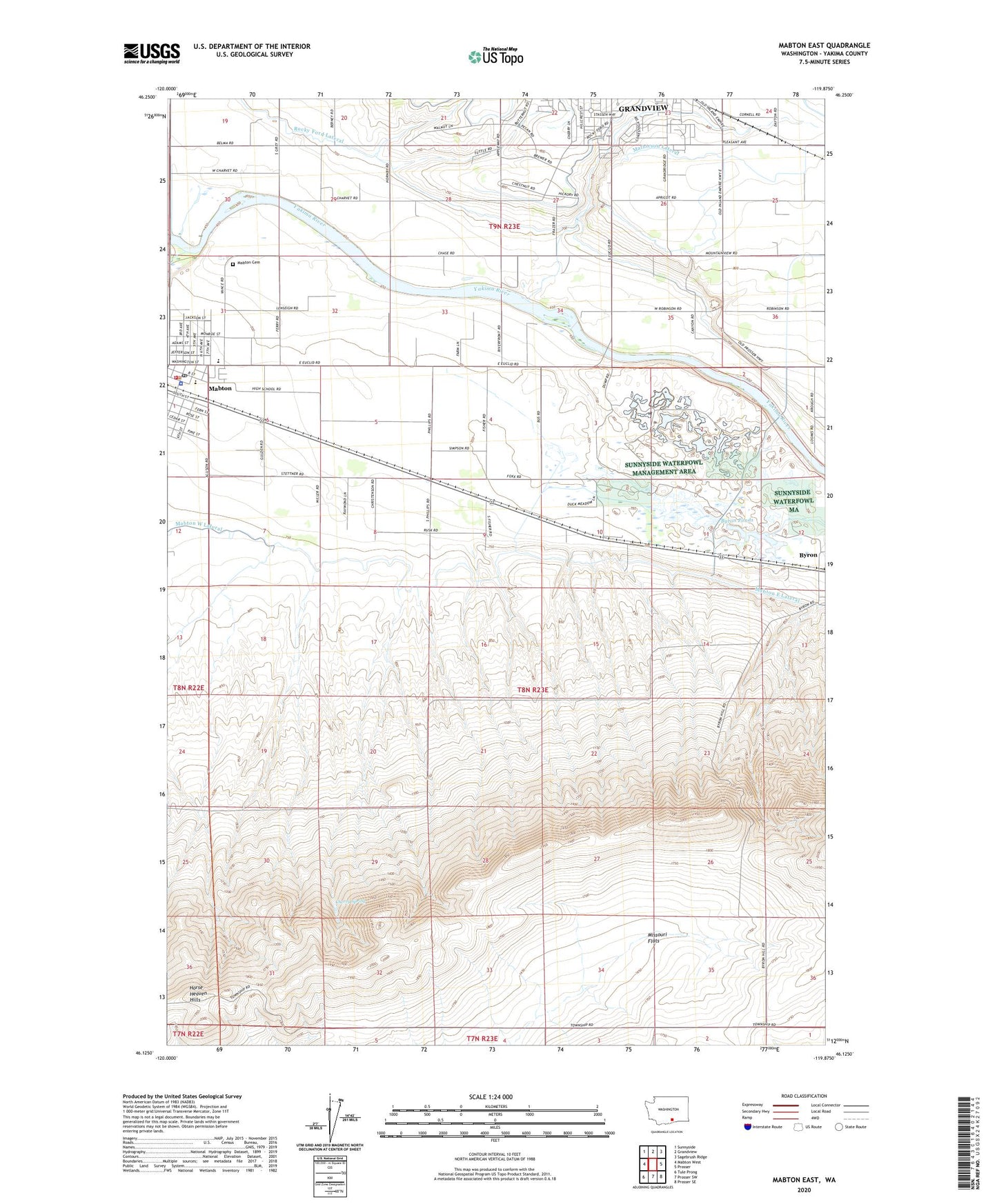
2023 topographic map quadrangle Mabton East in the state of Washington. Scale: 1:24000. Based on the newly updated USGS 7.5' US Topo map series, this map is in the following counties: Yakima. The map contains contour data, water features, and other items you are used to seeing on USGS maps, but also has updated roads and other features. This is the next generation of topographic maps. Printed on high-quality waterproof paper with UV fade-resistant inks.
Quads adjacent to this one:
West: Mabton West
Northwest: Sunnyside
North: Grandview
Northeast: Sagebrush Ridge
East: Prosser
Southeast: Prosser SE
South: Prosser SW
Southwest: Tule Prong
This map covers the same area as the classic USGS quad with code o46119b8.
Contains the following named places: Artz Fox Elementary School, Artz-Fox Elementary School, Byron Ponds, Byron Ponds Dam, Cherry Spring, City of Grandview, City of Mabton, Mabton, Mabton Cemetery, Mabton Junior Senior High School, Mabton Police Department, Mabton Post Office, Mabton Siphon, Mabton West Lateral, Mathieson Lateral, Missouri Flats, Rocky Ford Lateral, Stassen Park, Sunnyside Waterfowl Management Area, Sunnyside Wildlife Recreation Area, Yakima County Fire District 5 Station 15 Mabton