MyTopo
Grandview Washington US Topo Map
Couldn't load pickup availability
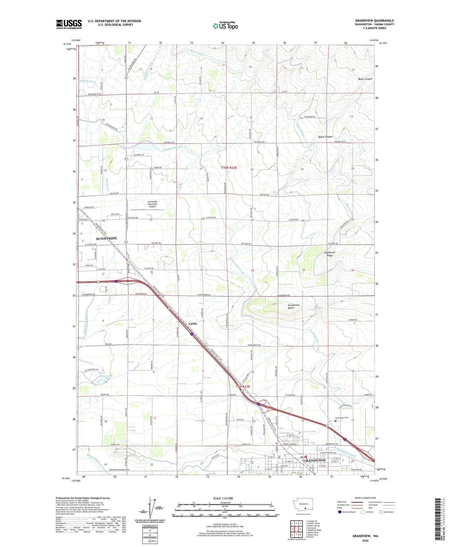
2023 topographic map quadrangle Grandview in the state of Washington. Scale: 1:24000. Based on the newly updated USGS 7.5' US Topo map series, this map is in the following counties: Yakima. The map contains contour data, water features, and other items you are used to seeing on USGS maps, but also has updated roads and other features. This is the next generation of topographic maps. Printed on high-quality waterproof paper with UV fade-resistant inks.
Quads adjacent to this one:
West: Sunnyside
Northwest: Granger NE
North: Sulphur Spring
Northeast: Maiden Spring
East: Sagebrush Ridge
Southeast: Prosser
South: Mabton East
Southwest: Mabton West
This map covers the same area as the classic USGS quad with code o46119c8.
Contains the following named places: Airport Ranch, Arthur E Smith Elementary School, Black Canyon, Blacks Corner, Blehyl Library and Powell Museum, East Turbine Lateral, Eastway Shopping Center, Forsell, Givens Corner, Grandview, Grandview Adventist Junior Academy, Grandview Butte, Grandview Cemetery, Grandview Elementary School, Grandview High School, Grandview Middle School, Grandview Police Department, Grandview Post Office, Grandview Water Shed, Harriet Thompson Elementary School, Harrison Middle School, Lichty, Lower Valley Golf Club, Marvin Eberle Dam, Oleys Lake, Outlook Siphon, Pumping Station Number 12, Pumping Station Number 13, Sagebrush Ridge, Sierra Vista Middle School, Sulphur Creek, Sunny-Grand Speedway, Sunnyside Canal, Sunnyside High School, Sunnyside Municipal Airport, West Turbine Lateral, Westside Park, Yakima County Fire District 5 Station 14 Grandview, ZIP Code: 98930