MyTopo
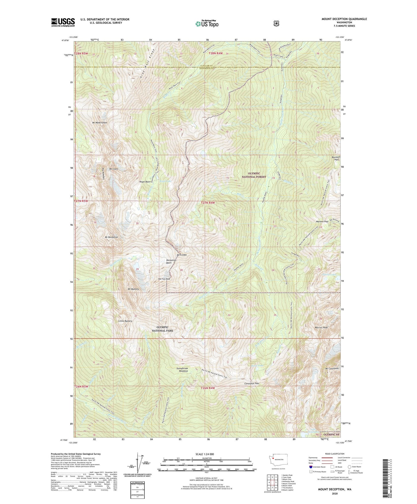
Mount Deception Washington US Topo Map
Couldn't load pickup availability
Also explore the Mount Deception Forest Service Topo of this same quad for updated USFS data
2023 topographic map quadrangle Mount Deception in the state of Washington. Scale: 1:24000. Based on the newly updated USGS 7.5' US Topo map series, this map is in the following counties: Jefferson, Clallam. The map contains contour data, water features, and other items you are used to seeing on USGS maps, but also has updated roads and other features. This is the next generation of topographic maps. Printed on high-quality waterproof paper with UV fade-resistant inks.
Quads adjacent to this one:
West: Wellesley Peak
Northwest: Maiden Peak
North: Tyler Peak
Northeast: Mount Zion
East: Mount Townsend
Southeast: Mount Jupiter
South: The Brothers
Southwest: Mount Steel
This map covers the same area as the classic USGS quad with code o47123g2.
Contains the following named places: Boulder Shelter, Buckhorn Pass, Buckhorn Wilderness, Camp Handy, Charlia Lakes, Constance Pass, Crag Creek, Deception Basin, Ghoul Creek, Hal Foss Peak, Hawk Creek, Heather Creek, Home Creek, Home Lake, Lake Constance, Little Mystery, Lower Twin Creek, Marmot Pass, Milk Creek, Mount Clark, Mount Constance, Mount Deception, Mount Fricaba, Mount Mystery, Mount Valerianos, Mount Walkinshaw, Royal Basin, Royal Creek, Royal Creek Cabin, Royal Creek Trail, Royal Lake, Slide Creek, Still Creek, Sunnybrook Meadows, The Needles, Upper Twin Creek, Warrior Peak, West Branch Home Creek