MyTopo
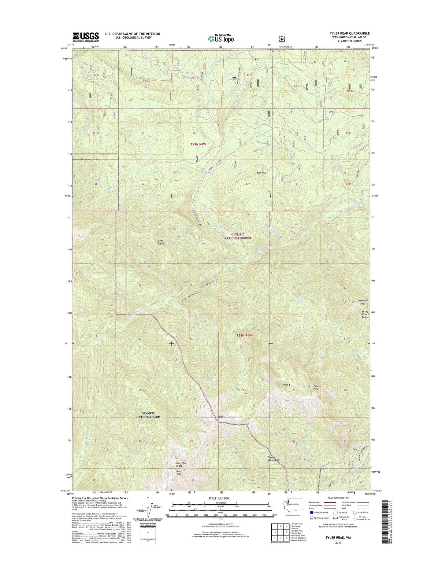
Tyler Peak Washington US Topo Map
Couldn't load pickup availability
Also explore the Tyler Peak Forest Service Topo of this same quad for updated USFS data
2023 topographic map quadrangle Tyler Peak in the state of Washington. Scale: 1:24000. Based on the newly updated USGS 7.5' US Topo map series, this map is in the following counties: Clallam. The map contains contour data, water features, and other items you are used to seeing on USGS maps, but also has updated roads and other features. This is the next generation of topographic maps. Printed on high-quality waterproof paper with UV fade-resistant inks.
Quads adjacent to this one:
West: Maiden Peak
Northwest: Morse Creek
North: Carlsborg
Northeast: Sequim
East: Mount Zion
Southeast: Mount Townsend
South: Mount Deception
Southwest: Wellesley Peak
This map covers the same area as the classic USGS quad with code o47123h2.
Contains the following named places: Baldy, Baldy Trail, Cameron Creek, Camp Ellis, Camp Tony, Cat Creek, Cliff Camp, Deer Ridge, Divide Creek, Grand Creek, Gray Wolf, Gray Wolf Camp, Gray Wolf Ridge, Maynard Burn Way, Maynard Peak, Mineral Spring, Mueller Creek, Ned Hill, Ned Hill Trail, Peak B, Slab Camp Creek, Slab Camp Guard Station, Slide Camp, Slide Creek, Sutherland Creek, Three Forks Shelter, Three O'Clock Ridge, Twin Creek, Twomile Camp, Tyler Peak