MyTopo
Malott Washington US Topo Map
Couldn't load pickup availability
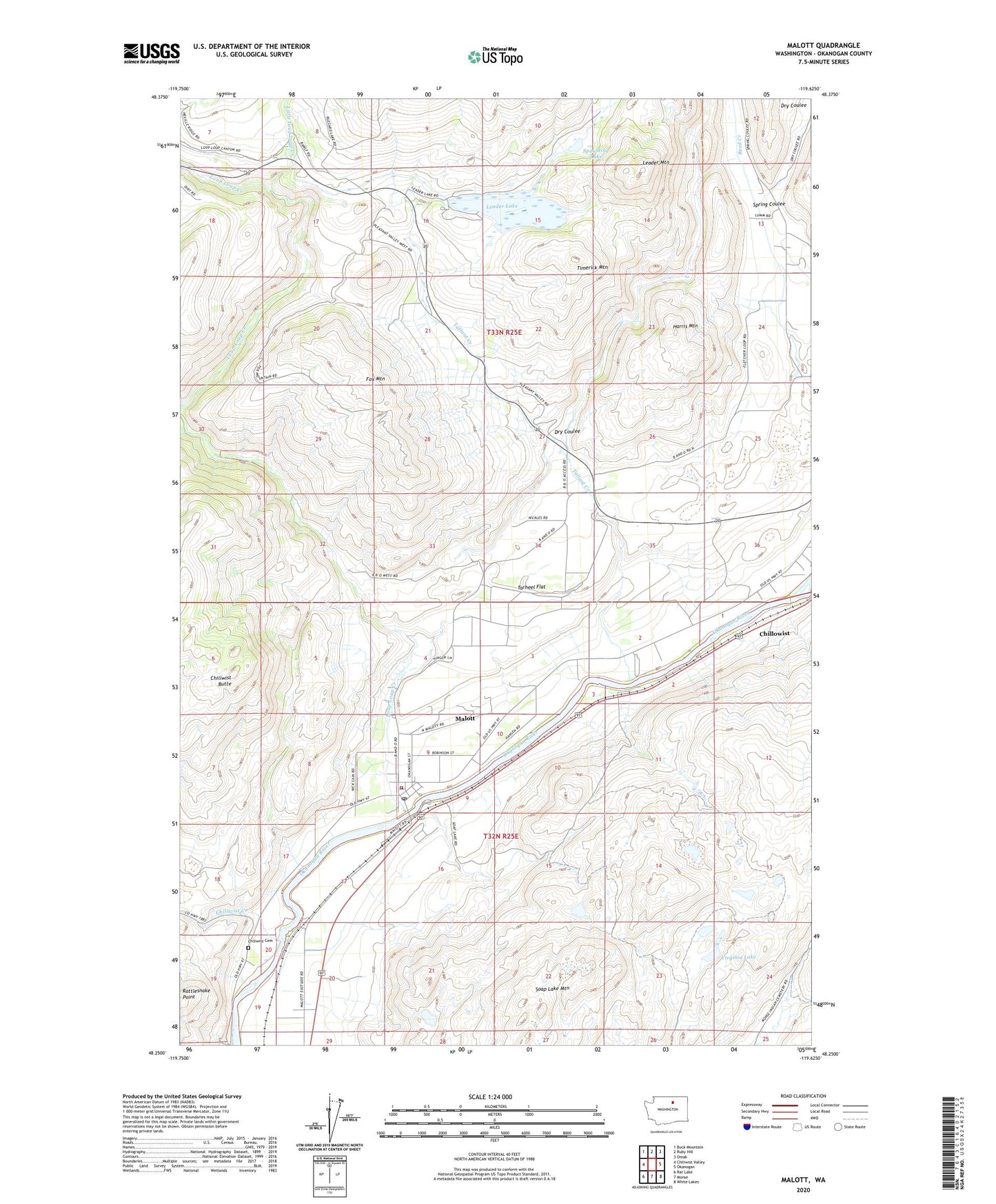
2023 topographic map quadrangle Malott in the state of Washington. Scale: 1:24000. Based on the newly updated USGS 7.5' US Topo map series, this map is in the following counties: Okanogan. The map contains contour data, water features, and other items you are used to seeing on USGS maps, but also has updated roads and other features. This is the next generation of topographic maps. Printed on high-quality waterproof paper with UV fade-resistant inks.
Quads adjacent to this one:
West: Chiliwist Valley
Northwest: Buck Mountain
North: Ruby Hill
Northeast: Omak
East: Okanogan
Southeast: White Lakes
South: Monse
Southwest: Rat Lake
This map covers the same area as the classic USGS quad with code o48119c6.
Contains the following named places: Chiliwist, Chiliwist Butte, Chiliwist Cemetery, Chiliwist Creek, Chiliwist State Wildlife Recreation Area, Chillowist, Dry Coulee, Fox Mountain, Harris Mountain, Leader Lake, Leader Lake Campground, Leader Lake Dam, Leader Lake Saddle Dam, Leader Mountain, Little Loup Loup Creek, Loup Loup Creek, M Bar J Ranch Mobile Home Park, Malott, Malott Census Designated Place, Malott Elementary School, Malott Fire Department, Malott Post Office, Okanogan Division, Reed Creek, Soap Lake Mountain, Spaulding Lake, Spring Coulee, Tallant Creek, Tarheel Flat, Timerick Mountain, Virginia Lake