MyTopo
Ruby Hill Washington US Topo Map
Couldn't load pickup availability
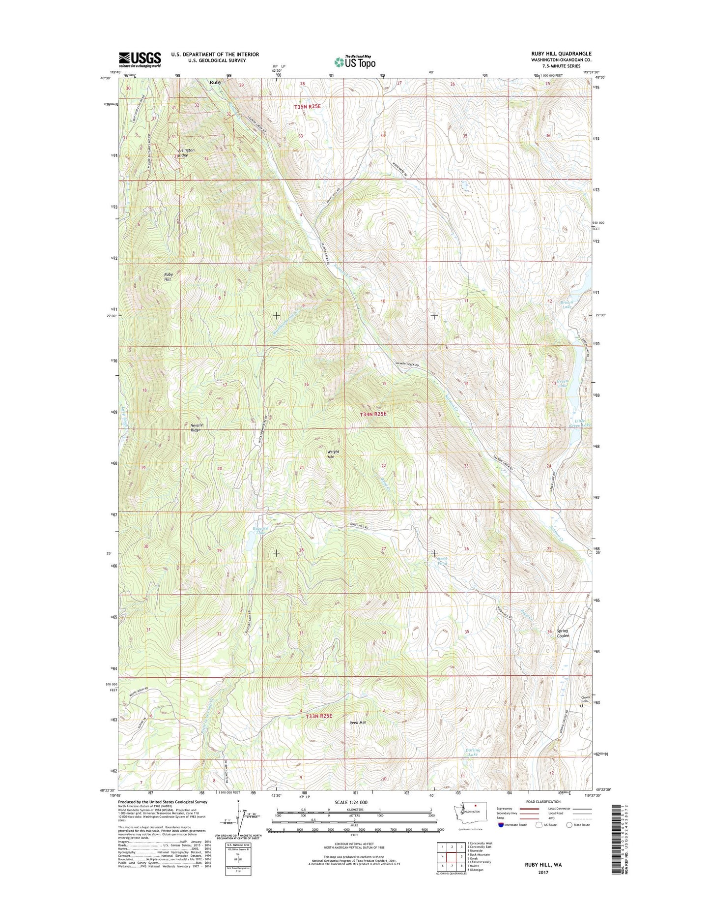
2023 topographic map quadrangle Ruby Hill in the state of Washington. Scale: 1:24000. Based on the newly updated USGS 7.5' US Topo map series, this map is in the following counties: Okanogan. The map contains contour data, water features, and other items you are used to seeing on USGS maps, but also has updated roads and other features. This is the next generation of topographic maps. Printed on high-quality waterproof paper with UV fade-resistant inks.
Quads adjacent to this one:
West: Buck Mountain
Northwest: Conconully West
North: Conconully East
Northeast: Riverside
East: Omak
Southeast: Okanogan
South: Malott
Southwest: Chiliwist Valley
This map covers the same area as the classic USGS quad with code o48119d6.
Contains the following named places: Arlington Mine, Arlington Ridge, Brown Lake, Buzzard Lake, Darling Lake, First Thought Mine, Fourth of July Mine, Green Lake, Houghs Mine, Last Chance Mine, Little Green Lake, Little Green Lake Dam, Loop Loop, Neville Ridge, Reed Mountain, Reed Pond, Ruby, Ruby Hill, Spring Coulee Family Cemetery, Woolloomooloo Creek, Wright Mountain