MyTopo
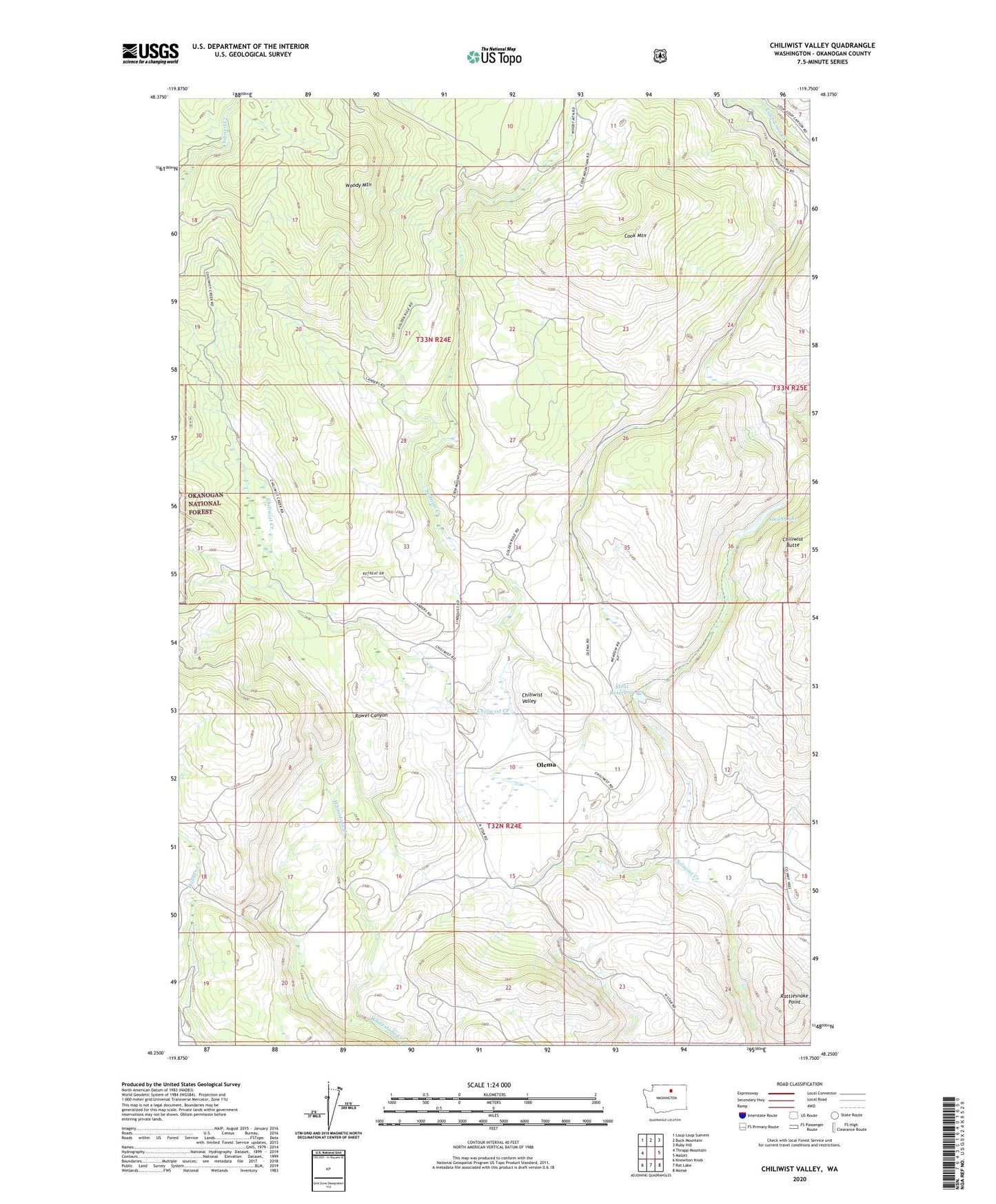
Chiliwist Valley Washington US Topo Map
Couldn't load pickup availability
Also explore the Chiliwist Valley Forest Service Topo of this same quad for updated USFS data
2023 topographic map quadrangle Chiliwist Valley in the state of Washington. Scale: 1:24000. Based on the newly updated USGS 7.5' US Topo map series, this map is in the following counties: Okanogan. The map contains contour data, water features, and other items you are used to seeing on USGS maps, but also has updated roads and other features. This is the next generation of topographic maps. Printed on high-quality waterproof paper with UV fade-resistant inks.
Quads adjacent to this one:
West: Thrapp Mountain
Northwest: Loup Loup Summit
North: Buck Mountain
Northeast: Ruby Hill
East: Malott
Southeast: Monse
South: Rat Lake
Southwest: Knowlton Knob
This map covers the same area as the classic USGS quad with code o48119c7.
Contains the following named places: Chiliwist Valley, Cook Mountain, Kercheval Ranch, Olema, Rattlesnake Point, Smith Lake, Stout Ranch, Stout Reservoir, Stout Reservoir Dam, Sullivan Creek, Woody Mountain, ZIP Code: 98829