MyTopo
McCartney Peak Washington US Topo Map
Couldn't load pickup availability
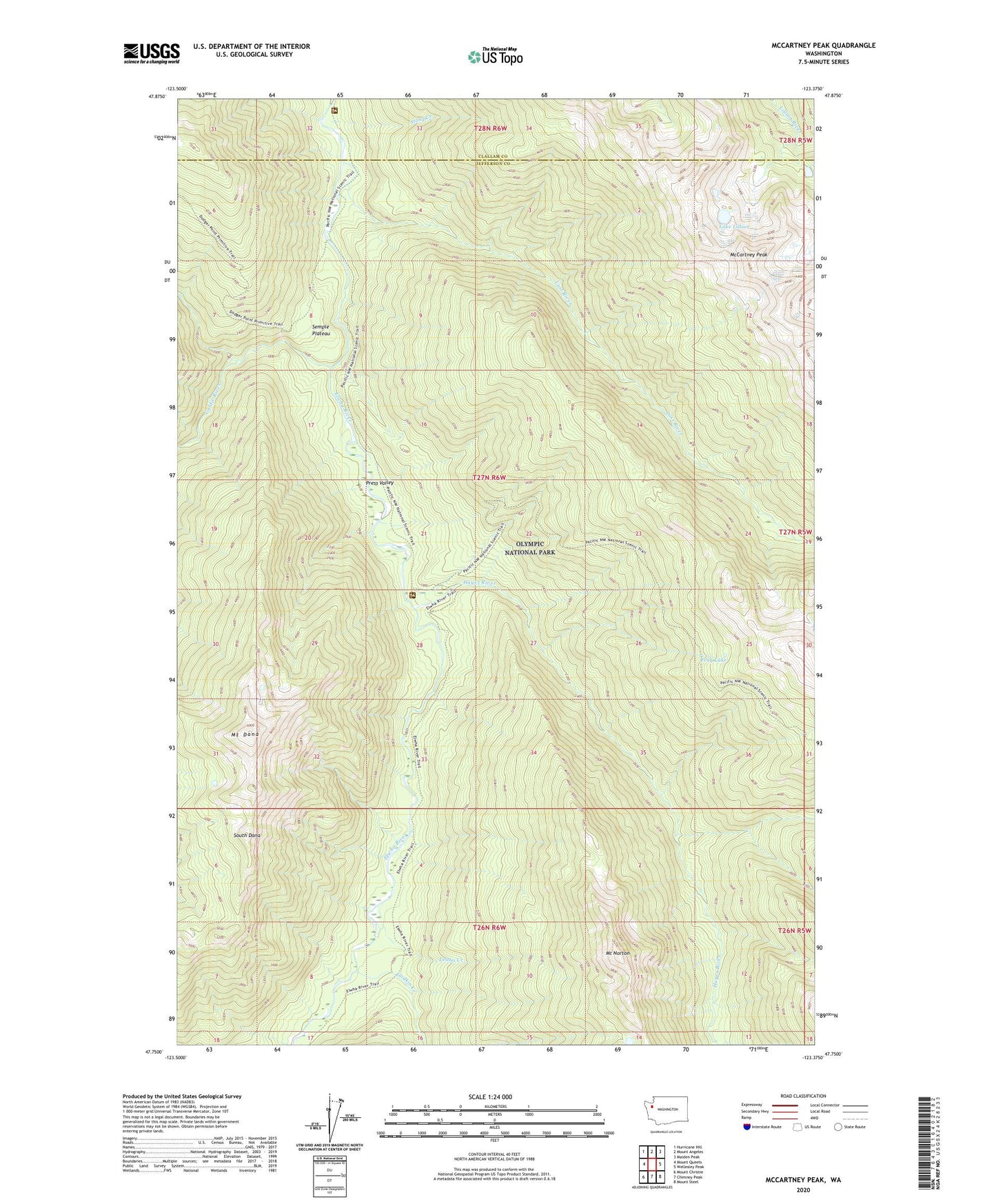
2020 topographic map quadrangle McCartney Peak in the state of Washington. Scale: 1:24000. Based on the newly updated USGS 7.5' US Topo map series, this map is in the following counties: Jefferson, Clallam. The map contains contour data, water features, and other items you are used to seeing on USGS maps, but also has updated roads and other features. This is the next generation of topographic maps. Printed on high-quality waterproof paper with UV fade-resistant inks.
Quads adjacent to this one:
West: Mount Queets
Northwest: Hurricane Hill
North: Mount Angeles
Northeast: Maiden Peak
East: Wellesley Peak
Southeast: Mount Steel
South: Chimney Peak
Southwest: Mount Christie
Contains the following named places: Camp Wilder, Chateau Camp, Elkhorn Guard Station, Elkhorn Ranger Station, Elwha River Trail, Frog Lake, Godkin Creek, Goldie River, Hayes River, Hayes River Guard Station, Lake Lillian, Leitha Creek, Lillian Glacier, Lost River, McCartney Peak, Mount Dana, Mount Norton, Press Valley, Semple Plateau, South Dana, Stony Creek, Stony Point Camp, Tipperary Camp