MyTopo
Matlock Washington US Topo Map
Couldn't load pickup availability
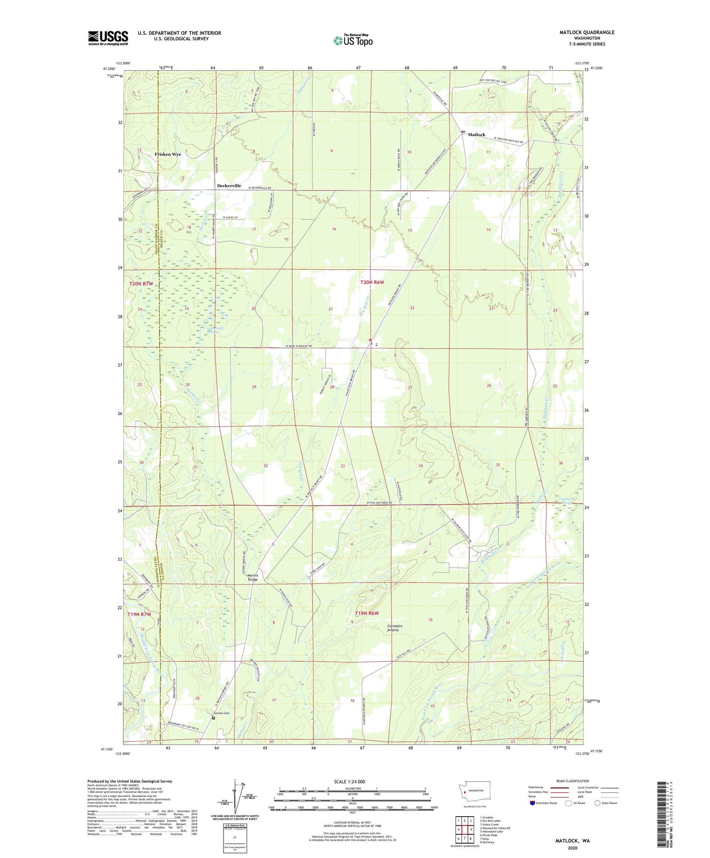
2023 topographic map quadrangle Matlock in the state of Washington. Scale: 1:24000. Based on the newly updated USGS 7.5' US Topo map series, this map is in the following counties: Mason, Grays Harbor. The map contains contour data, water features, and other items you are used to seeing on USGS maps, but also has updated roads and other features. This is the next generation of topographic maps. Printed on high-quality waterproof paper with UV fade-resistant inks.
Quads adjacent to this one:
West: Wynoochee Valley NE
Northwest: Grisdale
North: Dry Bed Lakes
Northeast: Vance Creek
East: Nahwatzel Lake
Southeast: McCleary
South: Elma
Southwest: Prices Peak
This map covers the same area as the classic USGS quad with code o47123b4.
Contains the following named places: Bingham Creek, Bingham Creek Trail, Carstairs Prairie, Deckerville, Deckerville Swamp, Dry Bed Creek, Frisken Wye, Grove Cemetery, Helene Creek, Martins Bridge, Mary M Knight Elementary School, Mason County Fire District 12, Matlock, Matlock Post Office, Outlet Creek, Scott Prairie, Simpson State Salmon Hatchery