MyTopo
McKenna Washington US Topo Map
Couldn't load pickup availability
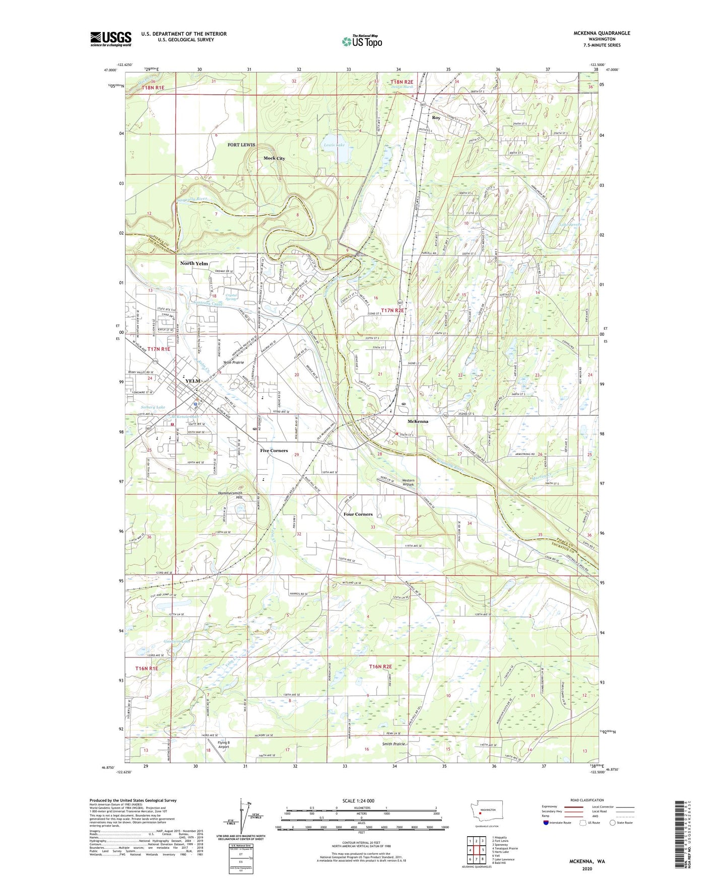
2023 topographic map quadrangle McKenna in the state of Washington. Scale: 1:24000. Based on the newly updated USGS 7.5' US Topo map series, this map is in the following counties: Thurston, Pierce. The map contains contour data, water features, and other items you are used to seeing on USGS maps, but also has updated roads and other features. This is the next generation of topographic maps. Printed on high-quality waterproof paper with UV fade-resistant inks.
Quads adjacent to this one:
West: Tenalquot Prairie
Northwest: Nisqually
North: Fort Lewis
Northeast: Spanaway
East: Harts Lake
Southeast: Bald Hill
South: Lake Lawrence
Southwest: Vail
This map covers the same area as the classic USGS quad with code o46122h5.
Contains the following named places: Centralia Canal, City of Roy, Crystal Spring, Denton Marsh, Five Corners, Flying B Airport, Fort Stevens Elementary School, Four Corners, Goodwin Lake, Hammersmith Hill, Jack Travis Estates Mobile Home Park, Lake Serene, Lewis Lake, McKenna, McKenna Census Designated Place, McKenna Elementary School, McKenna Heights Mobile Home Park, McKenna Post Office, McKenzie Lake, Mock City, Murray Creek, North Yelm, North Yelm Census Designated Place, Our Redeemer Lutheran School, Prairie Elementary School, Royal Oak Mobile Home Park, Serene Lake Dam, Solberg Lake, South Pierce Fire and Rescue Station 174, Southeast Thurston Fire Authority Station 21 Main, Tender Moments Daycare Center, Western Airpark, Yelm, Yelm Ditch, Yelm Extension School, Yelm Intermediate School, Yelm Middle School, Yelm Police Department, Yelm Post Office, Yelm Prairie, Yelm Seventh Day Adventist School, Yelm Sewage Treatment Plant, ZIP Codes: 98558, 98580