MyTopo
Bald Hill Washington US Topo Map
Couldn't load pickup availability
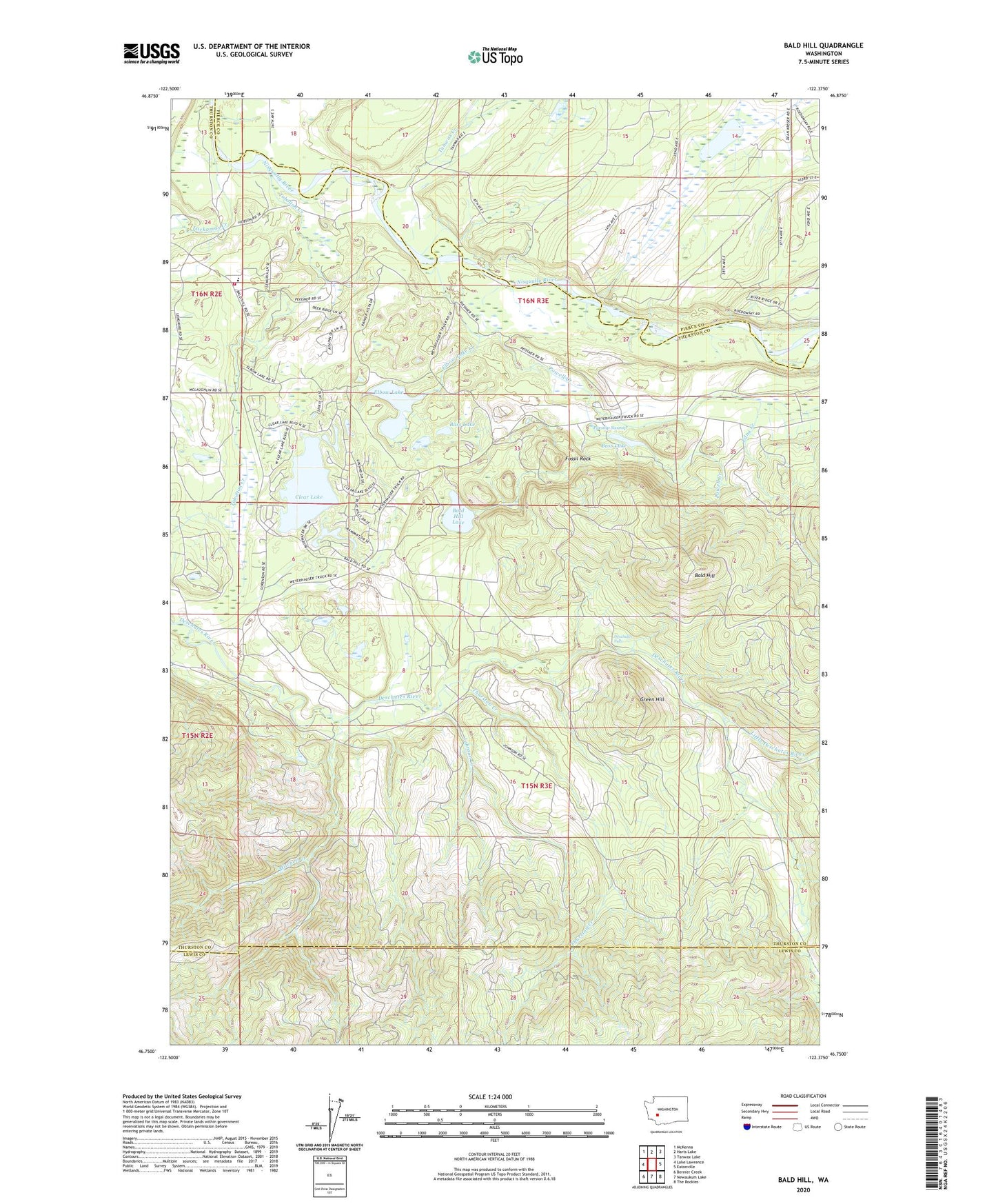
2023 topographic map quadrangle Bald Hill in the state of Washington. Scale: 1:24000. Based on the newly updated USGS 7.5' US Topo map series, this map is in the following counties: Thurston, Pierce, Lewis. The map contains contour data, water features, and other items you are used to seeing on USGS maps, but also has updated roads and other features. This is the next generation of topographic maps. Printed on high-quality waterproof paper with UV fade-resistant inks.
Quads adjacent to this one:
West: Lake Lawrence
Northwest: McKenna
North: Harts Lake
Northeast: Tanwax Lake
East: Eatonville
Southeast: The Rockies
South: Newaukum Lake
Southwest: Bernier Creek
This map covers the same area as the classic USGS quad with code o46122g4.
Contains the following named places: Bald Hill, Bald Hill Lake, Bass Lake, Beaver Dam, Clear Lake, Deschutes Falls, Edna Creek, Elbow Lake, Elbow Lake Creek, Fossil Rock, Green Hill, Johnson Creek, Kreger Lake, Lackamas Creek, Lackamas Elementary School, Little Deschutes River, Mitchell Creek, Muskrat Dam, Parsnip Swamp, Powell Creek, Tanwax Creek, Thurston County Fire District 17 Bald Hills Fire Department, Thurston Creek, Tobolton Creek, ZIP Code: 98597