MyTopo
Tenalquot Prairie Washington US Topo Map
Couldn't load pickup availability
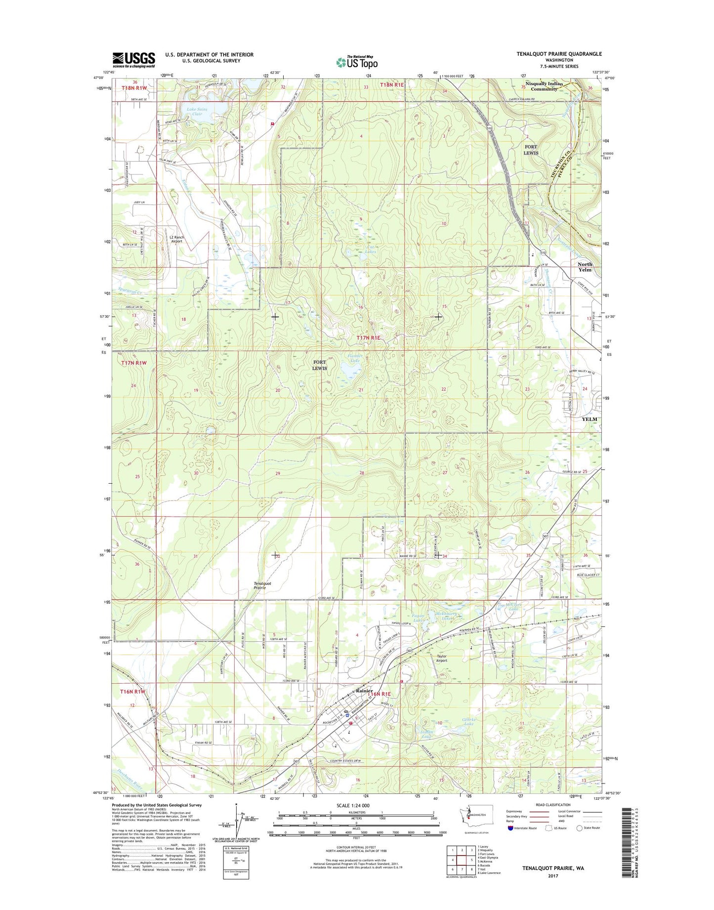
2023 topographic map quadrangle Tenalquot Prairie in the state of Washington. Scale: 1:24000. Based on the newly updated USGS 7.5' US Topo map series, this map is in the following counties: Thurston, Pierce. The map contains contour data, water features, and other items you are used to seeing on USGS maps, but also has updated roads and other features. This is the next generation of topographic maps. Printed on high-quality waterproof paper with UV fade-resistant inks.
Quads adjacent to this one:
West: East Olympia
Northwest: Lacey
North: Nisqually
Northeast: Fort Lewis
East: McKenna
Southeast: Lake Lawrence
South: Vail
Southwest: Bucoda
This map covers the same area as the classic USGS quad with code o46122h6.
Contains the following named places: Burnham Ranch, Cat Lakes, City of Rainier, City of Yelm, Collins School, Eaton Creek, Fagan Lake, Fiander Lake, Gehrke Lake, Inman Lake, Lacey Fire District 3 Station 32, LZ Ranch Airport, McClure Lake, McEnniery Lake, Olympia East Division, Oxbow Lake, Oxbow Lake Dam, P-L Ranch Airport, Rainier, Rainier Police Department, Rainier Post Office, Rainier Primary School, Rainier Senior High School, Rainier Tower, Southeast Thurston Fire Authority Station 24 Rainier, Southworth Elementary School, Taylor Airport, Tenalquot Prairie, Thompson Creek, Thurston County Fire Protection District 4, Yelm Creek, Yelm High School, ZIP Code: 98513