MyTopo
McLeod Mountain Washington US Topo Map
Couldn't load pickup availability
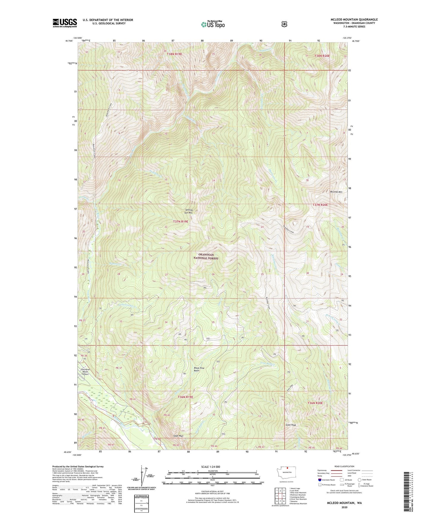
2020 topographic map quadrangle McLeod Mountain in the state of Washington. Scale: 1:24000. Based on the newly updated USGS 7.5' US Topo map series, this map is in the following counties: Okanogan. The map contains contour data, water features, and other items you are used to seeing on USGS maps, but also has updated roads and other features. This is the next generation of topographic maps. Printed on high-quality waterproof paper with UV fade-resistant inks.
Quads adjacent to this one:
West: Robinson Mountain
Northwest: Mount Lago
North: Lost Peak
Northeast: Billy Goat Mountain
East: Sweetgrass Butte
Southeast: Rendevous Mountain
South: Mazama
Southwest: Silver Star Mountain
Contains the following named places: Auburn Creek, Black Pine Basin, Black Pine Basin Trail, Eureka Creek, Gate Creek, Gate Creek Campground, Goat Peak, Hurricane Creek, Lost River Gorge, McGee Creek, McLeod Mountain, Monument Creek Trail, Setting Sun Mountain, Sunset Creek, Sunshine Creek, Weenan Creek, Yellowjacket, Yellowjacket Creek