MyTopo
Silver Star Mountain Washington US Topo Map
Couldn't load pickup availability
Also explore the Silver Star Mountain Forest Service Topo of this same quad for updated USFS data
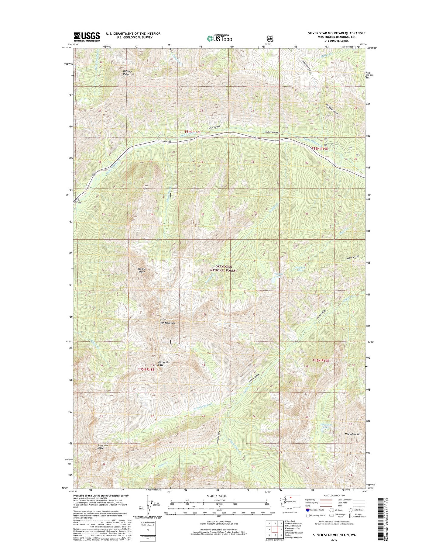
2023 topographic map quadrangle Silver Star Mountain in the state of Washington. Scale: 1:24000. Based on the newly updated USGS 7.5' US Topo map series, this map is in the following counties: Okanogan. The map contains contour data, water features, and other items you are used to seeing on USGS maps, but also has updated roads and other features. This is the next generation of topographic maps. Printed on high-quality waterproof paper with UV fade-resistant inks.
Quads adjacent to this one:
West: Washington Pass
Northwest: Slate Peak
North: Robinson Mountain
Northeast: McLeod Mountain
East: Mazama
Southeast: Midnight Mountain
South: Gilbert
Southwest: McAlester Mountain
This map covers the same area as the classic USGS quad with code o48120e5.
Contains the following named places: Delancy Ridge, Dolly Lake, Driveway Butte Trail, Kangaroo Ridge, Klipchuck Campground, Mudhole Lake, North Gardner Mountain, Pine Creek, Shelokum Lake, Silver Star Creek, Silver Star Mountain, Snagtooth Ridge, South Fork Cedar Creek, Varden Creek, Varden Lake, Vasiliki Ridge, West Fork Cedar Creek