MyTopo
Methow Washington US Topo Map
Couldn't load pickup availability
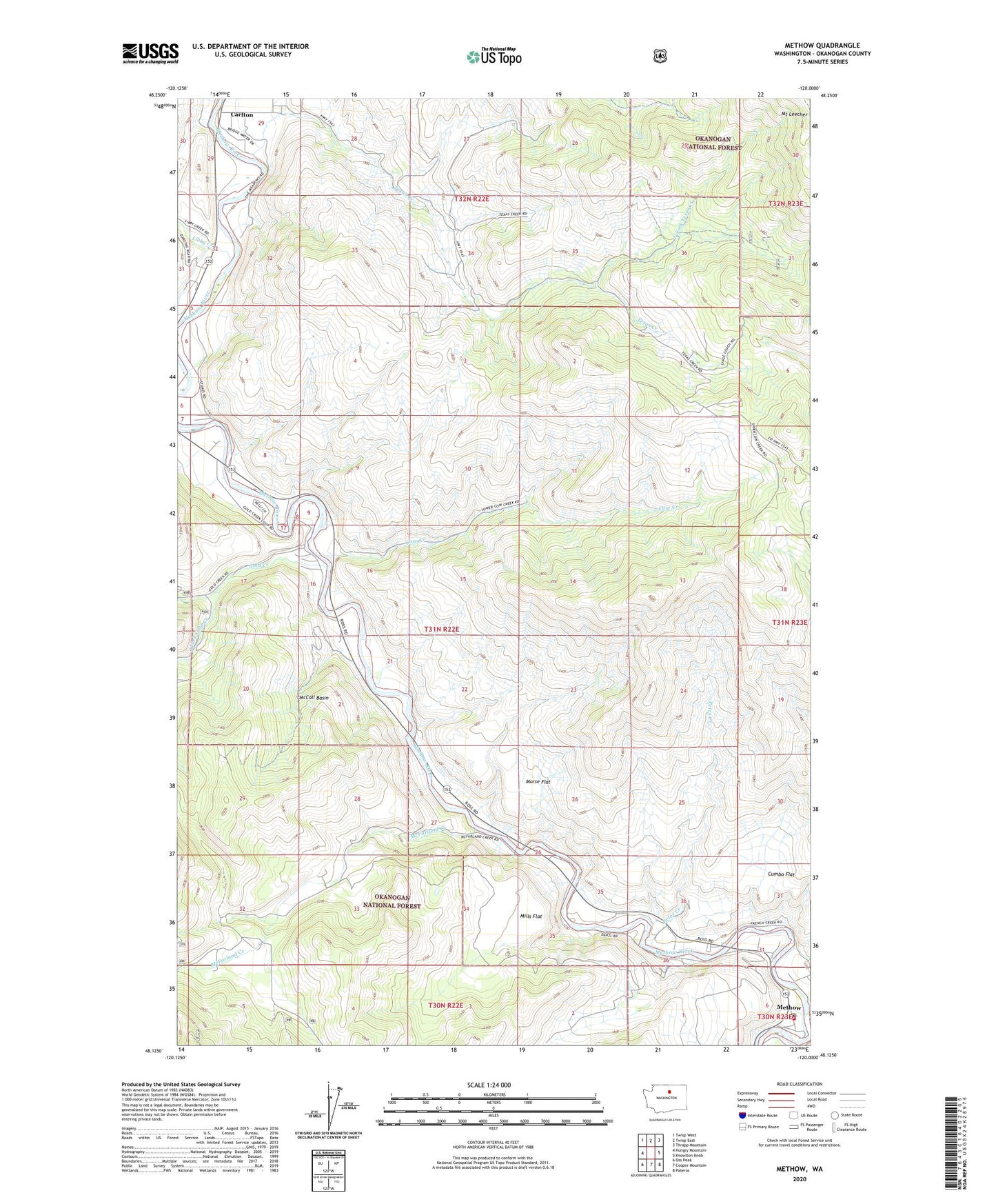
2020 topographic map quadrangle Methow in the state of Washington. Scale: 1:24000. Based on the newly updated USGS 7.5' US Topo map series, this map is in the following counties: Okanogan. The map contains contour data, water features, and other items you are used to seeing on USGS maps, but also has updated roads and other features. This is the next generation of topographic maps. Printed on high-quality waterproof paper with UV fade-resistant inks.
Quads adjacent to this one:
West: Hungry Mountain
Northwest: Twisp West
North: Twisp East
Northeast: Thrapp Mountain
East: Knowlton Knob
Southeast: Pateros
South: Cooper Mountain
Southwest: Oss Peak
Contains the following named places: Carlton, Cow Creek, Cumbo Flat, Douglas - Okanogan County Fire District 15 Methow Station 30, French Creek, Gold Creek, Libby Creek, Lightning Pine Recreational Vehicle Park, McCall Basin, McFarland Creek, Methow, Methow Census Designated Place, Methow Community Church, Methow Post Office, Methow Valley, Mills Flat, Morse Canyon, Morse Flat, Mulhollan Gulch, North Fork Texas Creek, Petes Creek, Pianosa Flying Farm, Puckett Creek, South Fork Gold Creek, Texas Creek, Vinegar Gulch