MyTopo
Mica Mountain Washington US Topo Map
Couldn't load pickup availability
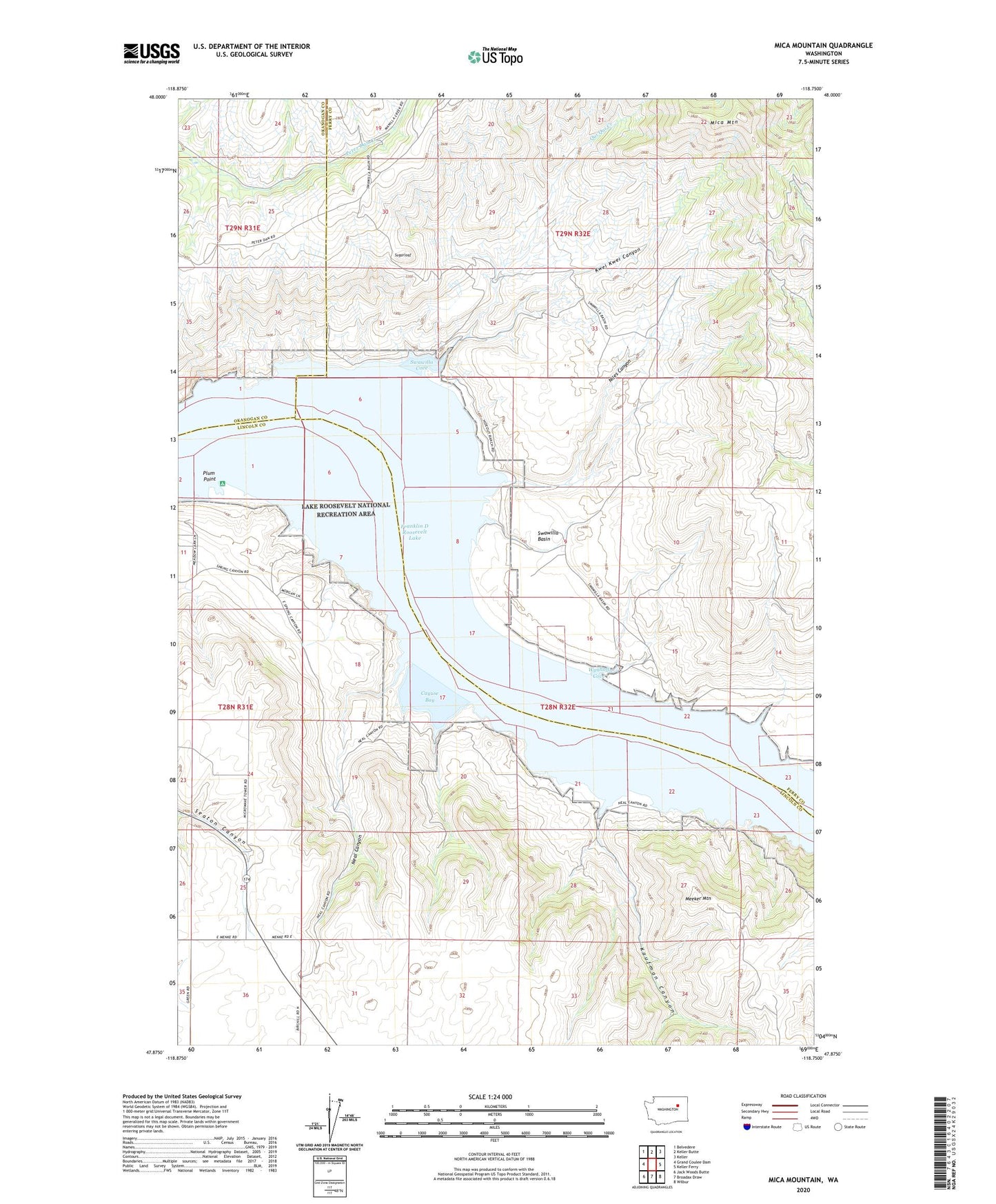
2020 topographic map quadrangle Mica Mountain in the state of Washington. Scale: 1:24000. Based on the newly updated USGS 7.5' US Topo map series, this map is in the following counties: Ferry, Lincoln, Okanogan. The map contains contour data, water features, and other items you are used to seeing on USGS maps, but also has updated roads and other features. This is the next generation of topographic maps. Printed on high-quality waterproof paper with UV fade-resistant inks.
Quads adjacent to this one:
West: Grand Coulee Dam
Northwest: Belvedere
North: Keller Butte
Northeast: Keller
East: Keller Ferry
Southeast: Wilbur
South: Broadax Draw
Southwest: Jack Woods Butte
Contains the following named places: Cayuse Bay, Kaufman Canyon, Kwei Kwei Canyon, Meeker Mountain, Mica Mountain, Neal Canyon, Niles Canyon, Plum Microwave Tower and Station, Plum Point, Qui Qui Creek, Sugarloaf, Swawilla Basin, Swawilla Cove, Wynhoff Cove