MyTopo
Belvedere Washington US Topo Map
Couldn't load pickup availability
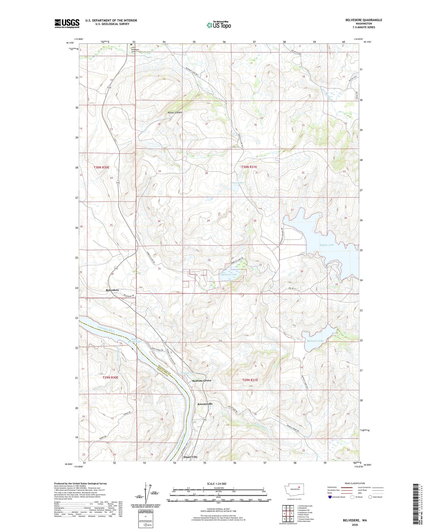
2023 topographic map quadrangle Belvedere in the state of Washington. Scale: 1:24000. Based on the newly updated USGS 7.5' US Topo map series, this map is in the following counties: Okanogan, Douglas. The map contains contour data, water features, and other items you are used to seeing on USGS maps, but also has updated roads and other features. This is the next generation of topographic maps. Printed on high-quality waterproof paper with UV fade-resistant inks.
Quads adjacent to this one:
West: Sanderson Creek
Northwest: Armstrong Creek
North: Nespelem
Northeast: Nespelem NE
East: Keller Butte
Southeast: Mica Mountain
South: Grand Coulee Dam
Southwest: Electric City
This map covers the same area as the classic USGS quad with code o48118a8.
Contains the following named places: Barry, Belvedere, Buffalo Lake, Five Lakes, Koontzville, Little Nespelem Cemetery, McGinnis Lake, Peter Dan Creek, Rebecca Lake, Sanderson Creek, Seatons Grove, Seatons Lake, Seatons Lake Dam, ZIP Code: 99116