MyTopo
Steamboat Rock SW Washington US Topo Map
Couldn't load pickup availability
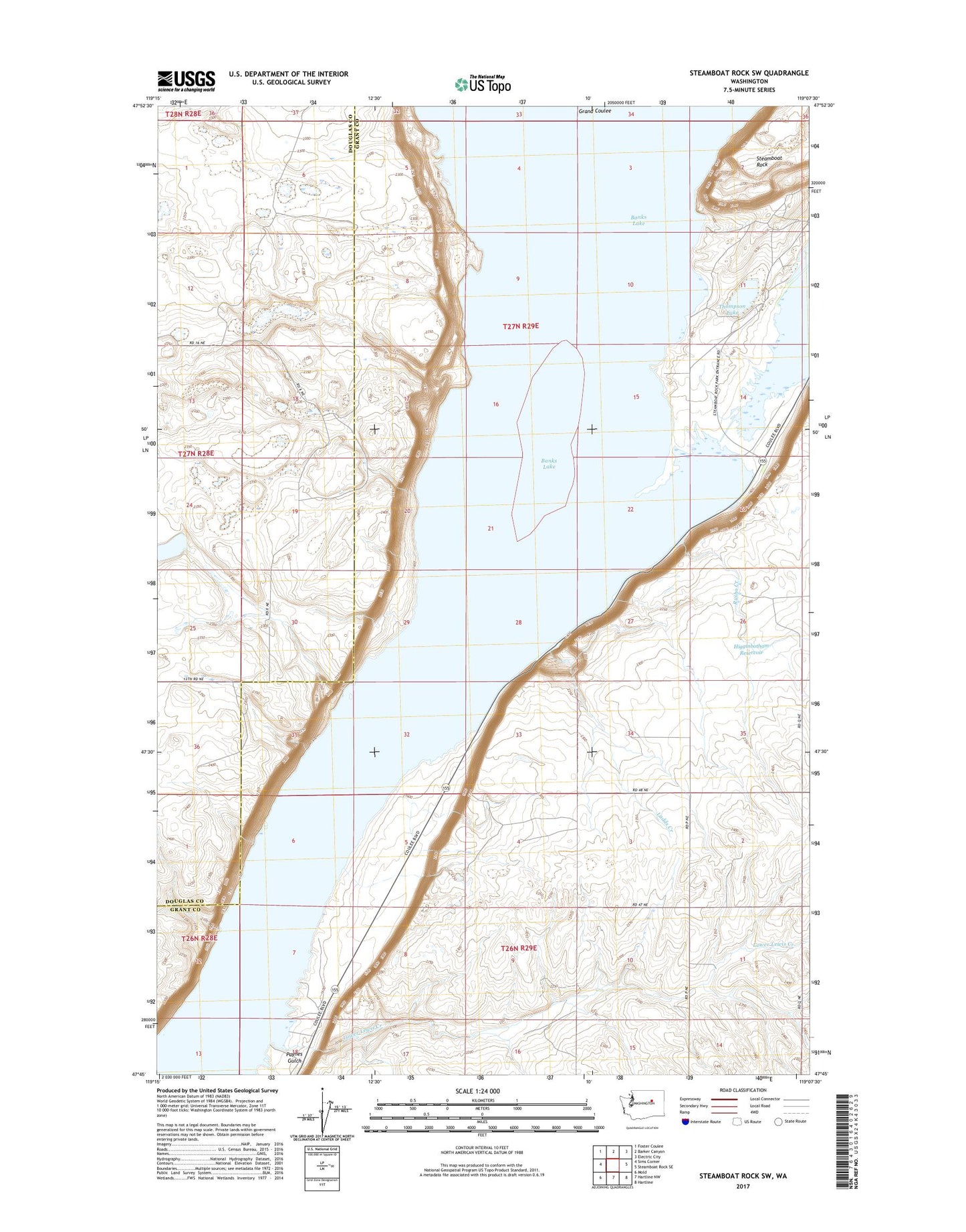
2023 topographic map quadrangle Steamboat Rock SW in the state of Washington. Scale: 1:24000. Based on the newly updated USGS 7.5' US Topo map series, this map is in the following counties: Grant, Douglas. The map contains contour data, water features, and other items you are used to seeing on USGS maps, but also has updated roads and other features. This is the next generation of topographic maps. Printed on high-quality waterproof paper with UV fade-resistant inks.
Quads adjacent to this one:
West: Sims Corner
Northwest: Foster Coulee
North: Barker Canyon
Northeast: Electric City
East: Steamboat Rock SE
Southeast: Hartline
South: Hartline NW
Southwest: Mold
This map covers the same area as the classic USGS quad with code o47119g2.
Contains the following named places: Banks Lake, Banks Lake Wildlife Recreation Area, Higginbotham Reservoir, Higginbotham Reservoir Dam, Ladds Creek, Lower Lewis Creek, Paynes Gulch, Poplars Picnic Area, Rusho Creek, Steamboat Rock, Steamboat Rock State Park, Thompson Lake, ZIP Code: 99123