MyTopo
Morse Creek Washington US Topo Map
Couldn't load pickup availability
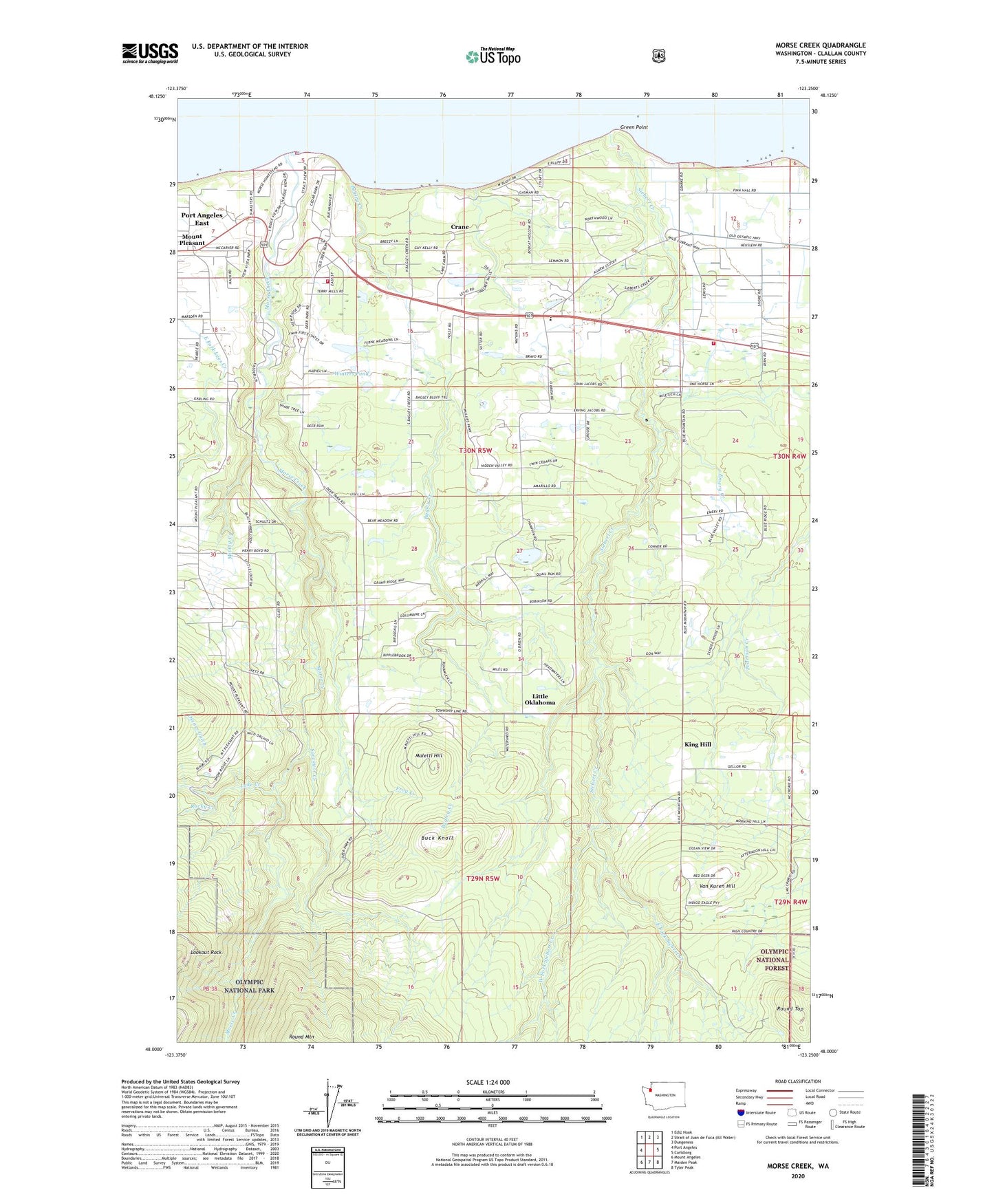
2020 topographic map quadrangle Morse Creek in the state of Washington. Scale: 1:24000. Based on the newly updated USGS 7.5' US Topo map series, this map is in the following counties: Clallam. The map contains contour data, water features, and other items you are used to seeing on USGS maps, but also has updated roads and other features. This is the next generation of topographic maps. Printed on high-quality waterproof paper with UV fade-resistant inks.
Quads adjacent to this one:
West: Port Angeles
Northwest: Ediz Hook
Northeast: Dungeness
East: Carlsborg
Southeast: Tyler Peak
South: Maiden Peak
Southwest: Mount Angeles
Contains the following named places: Bagley Creek, Bayview Mobile Home Park, Blue Mountain Community Hall, Blue Mountain Quarry, Buck Knoll, Cameron Homestead, Clallam County Fire District 2 Station 25 Deer Park, Clallam County Fire District 3 Station 32 R - Corner, Constant Hope Fellowship Church, Crane, Danz Ranch, Dutro Dam, East Fork Siebert Creek, Emery Creek, Fairview Bible Church, Fairview Elementary School, Fairview Hall, Fairview School, Finn Hall, Frog Creek, Green Point, Hambly Ranch, King Hill, Lake Creek, Little Oklahoma, Little Oklahoma Ranch, Lookout Rock, Maletti Hill, Mining Creek, Morse Creek, Morse Creek Quarry, Mount Pleasant, Mount Pleasant Community Hall, Olympic Christian School, Oscars Gulch, Peters Mobile Home Park, Port Angeles Dam, Port Angeles East Census Designated Place, R Corner, Rains Cedar Park Quarry, Rains Dam, Rf Wellcome Dam, Rocky Creek, Round Mountain, Round Top, Siebert Creek, Surveyor Creek, Thompson Heliport, Van Kuren Hill, View Vista Mobile Home Park, West Fork Siebert Creek, Winters Pond, Winters Pond Dam