MyTopo
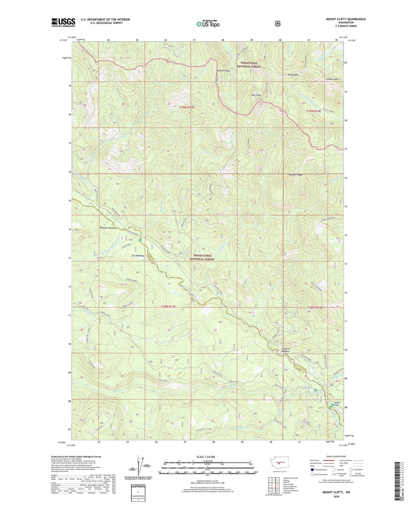
Mount Clifty Washington US Topo Map
Couldn't load pickup availability
Also explore the Mount Clifty Forest Service Topo of this same quad for updated USFS data
2023 topographic map quadrangle Mount Clifty in the state of Washington. Scale: 1:24000. Based on the newly updated USGS 7.5' US Topo map series, this map is in the following counties: Kittitas, Yakima. The map contains contour data, water features, and other items you are used to seeing on USGS maps, but also has updated roads and other features. This is the next generation of topographic maps. Printed on high-quality waterproof paper with UV fade-resistant inks.
Quads adjacent to this one:
West: Raven Roost
Northwest: Blowout Mountain
North: Easton
Northeast: Ronald
East: Quartz Mountain
Southeast: Cliffdell
South: Old Scab Mountain
Southwest: Goose Prairie
This map covers the same area as the classic USGS quad with code o47121a2.
Contains the following named places: Bear Creek, Blazed Ridge, Crow Creek, Cub Creek, Granite Creek Trail, Jungle Creek, Jungle Creek Campsite, Kaner Flat, Kaner Flat Campground, Longmile Meadows Campground, Longmire Meadow, Lookout Mountain, Lost Meadow, Manastash Ridge Trail, Mathew Creek, Mathew Meadow, Mount Cliffty Trail, Mount Clifty, Naches Pass Campsite, Panther Ridge, Pileup Creek, Quartz Creek, Sand Creek, South Fork Little Naches River, West Fork Bear Creek, West Quartz Creek, West Quartz Creek Falls, Windy Pass