MyTopo
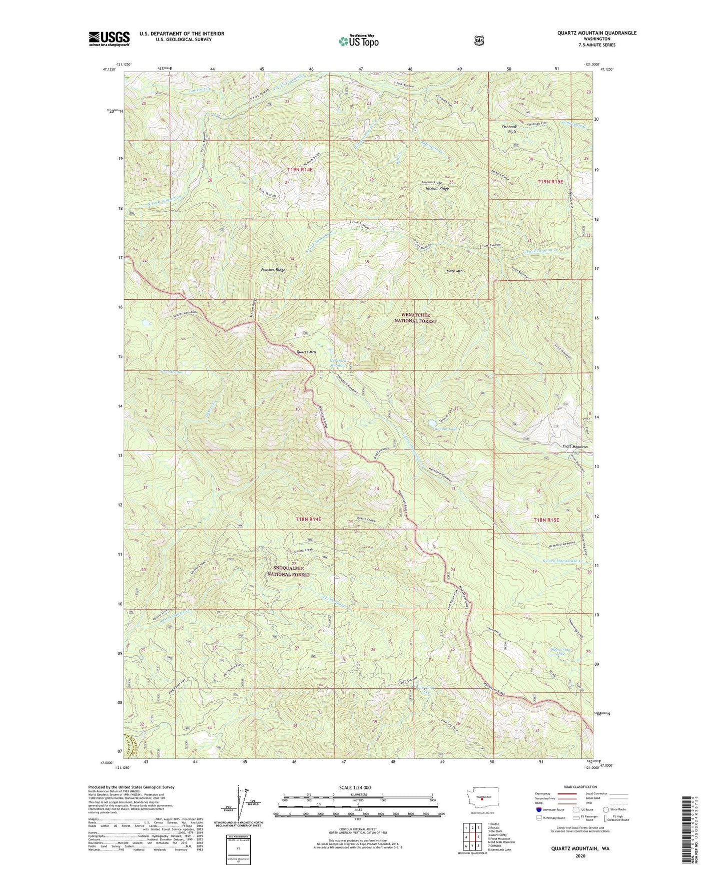
Quartz Mountain Washington US Topo Map
Couldn't load pickup availability
Also explore the Quartz Mountain Forest Service Topo of this same quad for updated USFS data
2023 topographic map quadrangle Quartz Mountain in the state of Washington. Scale: 1:24000. Based on the newly updated USGS 7.5' US Topo map series, this map is in the following counties: Kittitas, Yakima. The map contains contour data, water features, and other items you are used to seeing on USGS maps, but also has updated roads and other features. This is the next generation of topographic maps. Printed on high-quality waterproof paper with UV fade-resistant inks.
Quads adjacent to this one:
West: Mount Clifty
Northwest: Easton
North: Ronald
Northeast: Cle Elum
East: Frost Mountain
Southeast: Manastash Lake
South: Cliffdell
Southwest: Old Scab Mountain
This map covers the same area as the classic USGS quad with code o47121a1.
Contains the following named places: Disappointment Creek, Dry Meadow, Fishhook Flats, Fishhook Flats Trail, Frost Meadows, Frost Mountain Lookout Trail, Hereford Meadow, Kaner Flat Trail, Kid Creek, Lily Pond Lake, Lookout Creek, Mole Mountain, North Fork Taneum Trail, Peaches Ridge, Quartz Creek Trail, Quartz Mountain, Salvation Creek, Shoestring Lake, South Fork Quartz Creek, Taneum Lake, Taneum Ridge