MyTopo
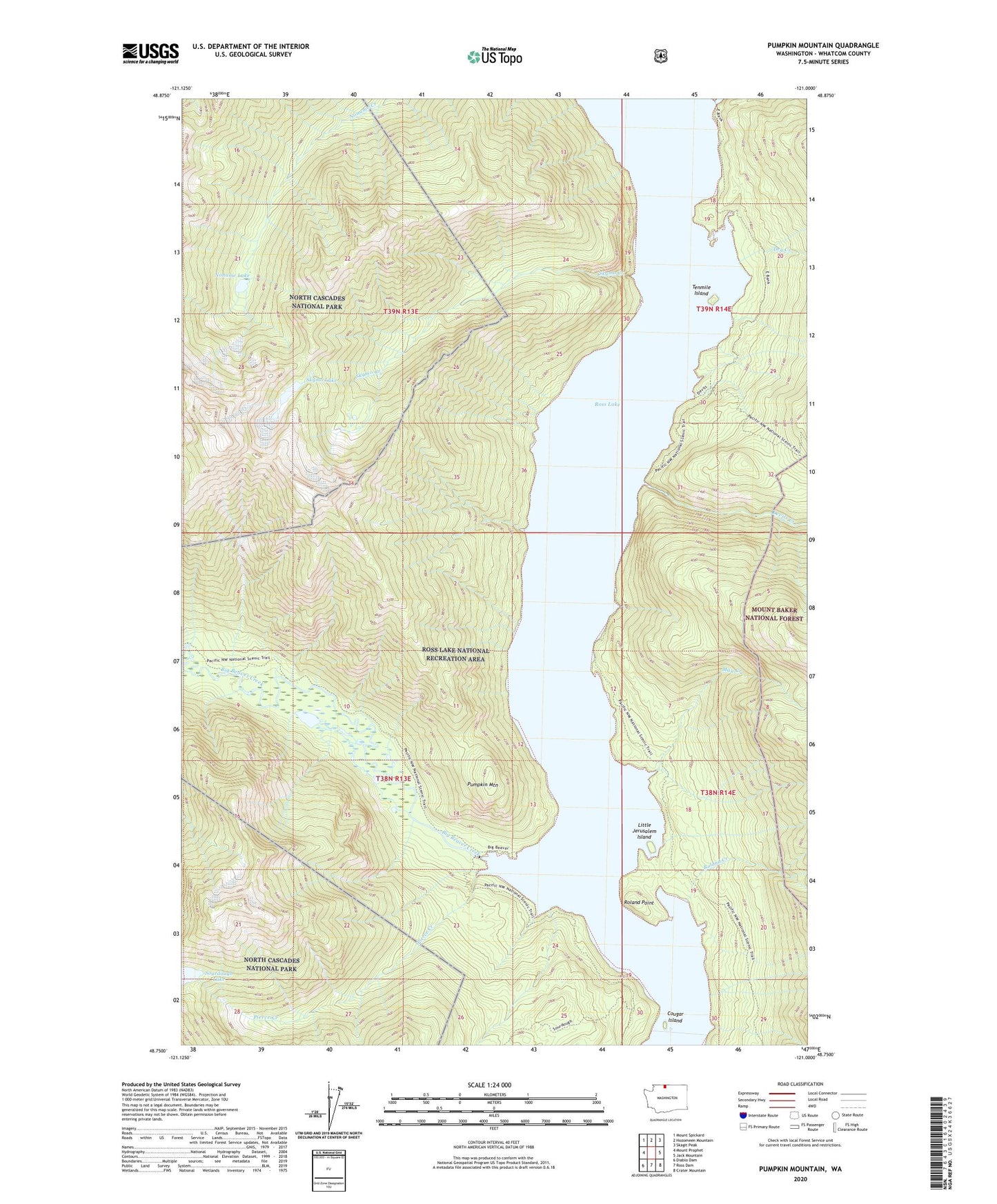
Pumpkin Mountain Washington US Topo Map
Couldn't load pickup availability
Also explore the Pumpkin Mountain Forest Service Topo of this same quad for updated USFS data
2023 topographic map quadrangle Pumpkin Mountain in the state of Washington. Scale: 1:24000. Based on the newly updated USGS 7.5' US Topo map series, this map is in the following counties: Whatcom. The map contains contour data, water features, and other items you are used to seeing on USGS maps, but also has updated roads and other features. This is the next generation of topographic maps. Printed on high-quality waterproof paper with UV fade-resistant inks.
Quads adjacent to this one:
West: Mount Prophet
Northwest: Mount Spickard
North: Hozomeen Mountain
Northeast: Skagit Peak
East: Jack Mountain
Southeast: Crater Mountain
South: Ross Dam
Southwest: Diablo Dam
This map covers the same area as the classic USGS quad with code o48121g1.
Contains the following named places: Big Bear Campground, Big Beaver Creek, Cougar Island, Cougar Island Campground, Devils Creek, Dry Creek, Dry Creek Camp, East Bank Trail, Lightning Creek, Little Jerusalem Island, May Creek, Noname Lake, Pierce Creek, Pumpkin Mountain, Rainbow Point Campground, Roland Creek, Roland Point, Ross Lake National Recreation Area, Skymo Creek, Skymo Lake, Sourdough Lake, Spencer Camp, Tenmile Island, Tenmile Island Campground