MyTopo
Mount Steel Washington US Topo Map
Couldn't load pickup availability
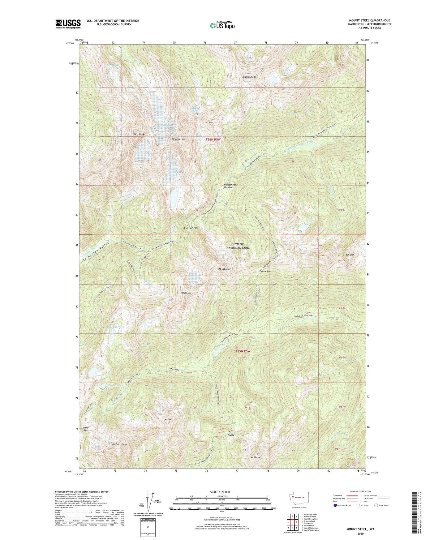
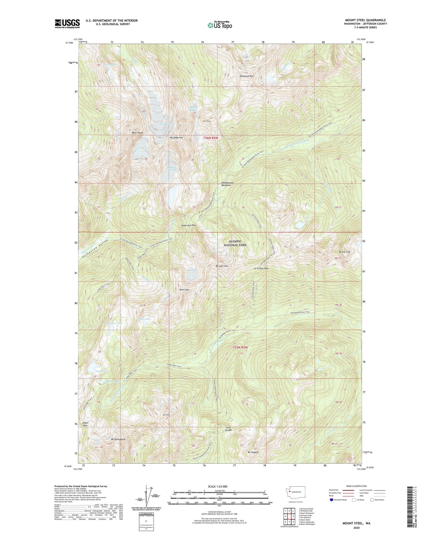
2020 topographic map quadrangle Mount Steel in the state of Washington. Scale: 1:24000. Based on the newly updated USGS 7.5' US Topo map series, this map is in the following counties: Jefferson. The map contains contour data, water features, and other items you are used to seeing on USGS maps, but also has updated roads and other features. This is the next generation of topographic maps. Printed on high-quality waterproof paper with UV fade-resistant inks.
Quads adjacent to this one:
West: Chimney Peak
Northwest: McCartney Peak
North: Wellesley Peak
Northeast: Mount Deception
East: The Brothers
Southeast: Mount Washington
South: Mount Skokomish
Southwest: Mount Olson
Contains the following named places: Anderson Creek, Anderson Glacier, Anderson Pass, Buck Lake, Diamond Meadow Shelter, Diamond Mountain, Duckabush Shelter, East Peak, Eel Glacier, Elk Lick Creek, First Divide, Hanging Glacier, Hart Lake, Home Sweet Home Shelter, Honeymoon Meadows, Honeymoon Meadows Ranger Station, Iceberg Lake, La Crosse Pass, Lake LaCrosse, Marmot Lake, Mount Anderson, Mount Duckabush, Mount Elk Lick, Mount Hopper, Mount LaCrosse, Mount Steel, O'Neil Pass, Two Bear Camp, West Peak, White Creek, White Mountain