MyTopo
Nahwatzel Lake Washington US Topo Map
Couldn't load pickup availability
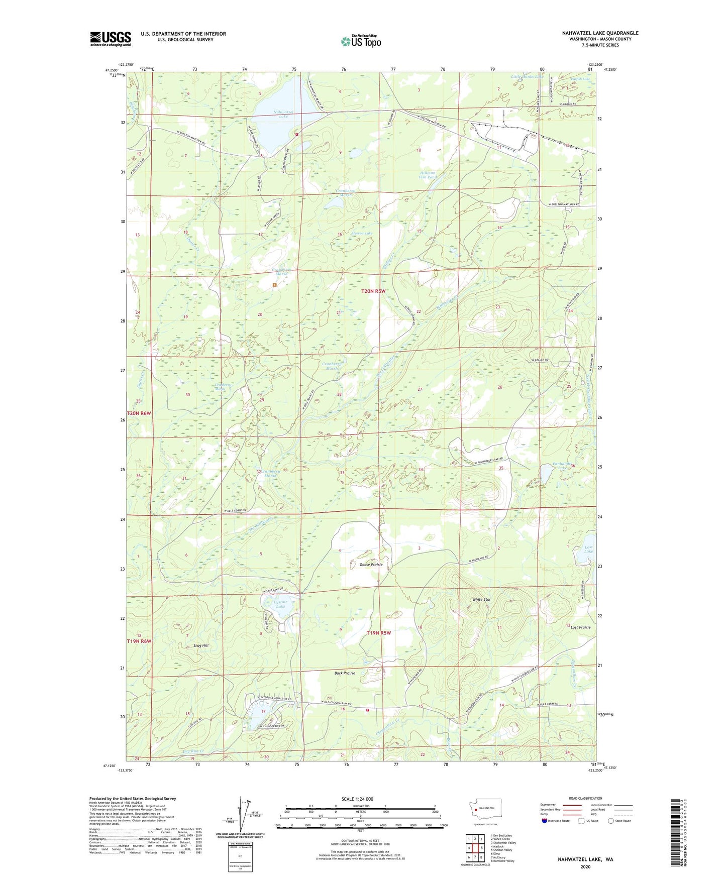
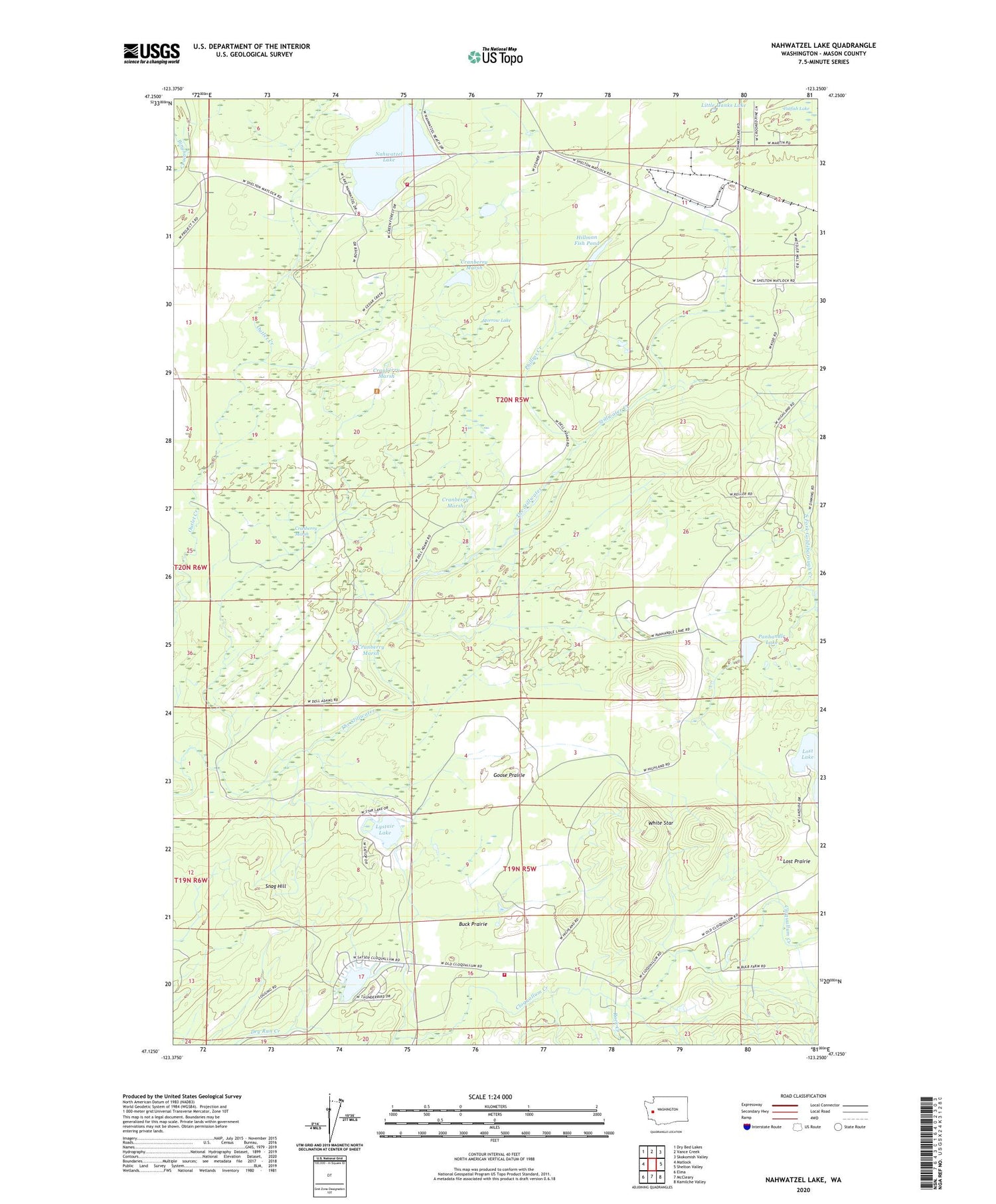
2020 topographic map quadrangle Nahwatzel Lake in the state of Washington. Scale: 1:24000. Based on the newly updated USGS 7.5' US Topo map series, this map is in the following counties: Mason. The map contains contour data, water features, and other items you are used to seeing on USGS maps, but also has updated roads and other features. This is the next generation of topographic maps. Printed on high-quality waterproof paper with UV fade-resistant inks.
Quads adjacent to this one:
West: Matlock
Northwest: Dry Bed Lakes
North: Vance Creek
Northeast: Skokomish Valley
East: Shelton Valley
Southeast: Kamilche Valley
South: McCleary
Southwest: Elma
Contains the following named places: Buck Prairie, Camp Bishop, Camp Roland, Catfish Lake, Cloquallum, Cloquallum Grange, Cranberry Marsh, Goose Prairie, Hillman Fish Pond, Lake Arrowhead, Lystair Lake, Mason County Fire Protection District 13, Morrow Lake, Nahwatzel Lake, Panhandle Lake, Phillips Creek, Rock Creek, Snag Hill, Stillwater Creek, The Stillwater, White Star