MyTopo
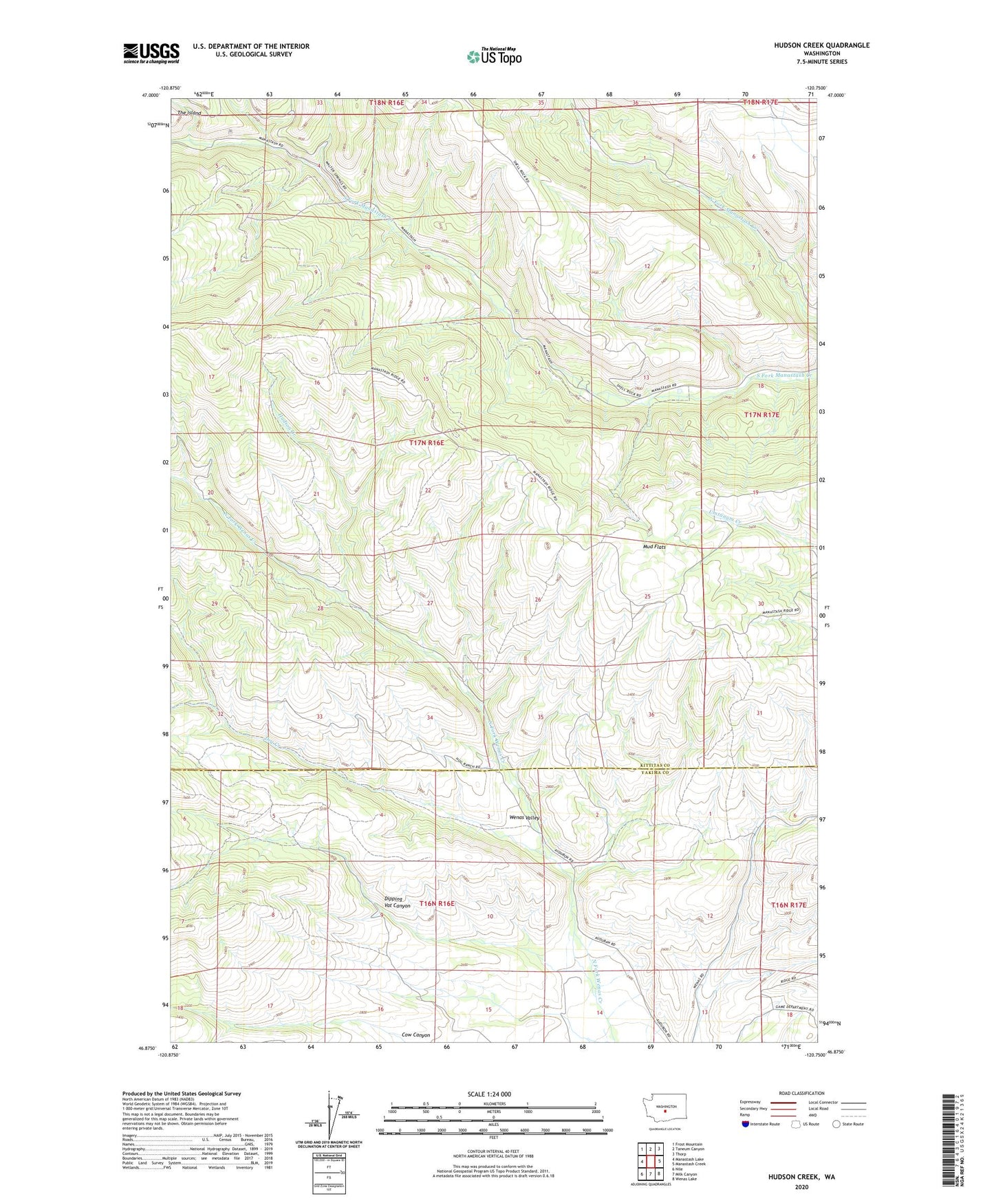
Hudson Creek Washington US Topo Map
Couldn't load pickup availability
Also explore the Hudson Creek Forest Service Topo of this same quad for updated USFS data
2023 topographic map quadrangle Hudson Creek in the state of Washington. Scale: 1:24000. Based on the newly updated USGS 7.5' US Topo map series, this map is in the following counties: Kittitas, Yakima. The map contains contour data, water features, and other items you are used to seeing on USGS maps, but also has updated roads and other features. This is the next generation of topographic maps. Printed on high-quality waterproof paper with UV fade-resistant inks.
Quads adjacent to this one:
West: Manastash Lake
Northwest: Frost Mountain
North: Taneum Canyon
Northeast: Thorp
East: Manastash Creek
Southeast: Wenas Lake
South: Milk Canyon
Southwest: Nile
This map covers the same area as the classic USGS quad with code o46120h7.
Contains the following named places: Dipping Vat Canyon, Dry Creek, Hudson Creek, Mud Flats, Wenas Camp, Yellow Jacket Creek