
MyTopo
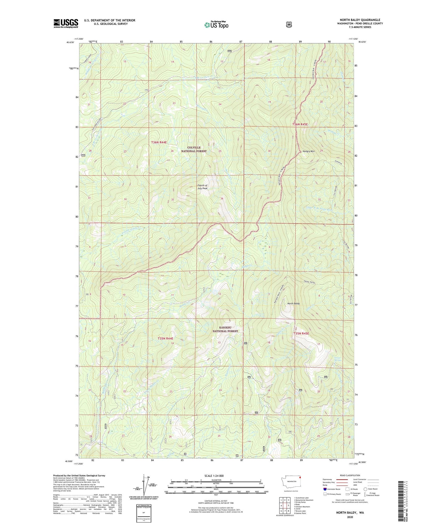
North Baldy Washington US Topo Map
Couldn't load pickup availability
2020 topographic map quadrangle North Baldy in the state of Washington. Scale: 1:24000. Based on the newly updated USGS 7.5' US Topo map series, this map is in the following counties: Pend Oreille. The map contains contour data, water features, and other items you are used to seeing on USGS maps, but also has updated roads and other features. This is the next generation of topographic maps. Printed on high-quality waterproof paper with UV fade-resistant inks.
Quads adjacent to this one:
West: Ruby
Northwest: Scotchman Lake
North: Monumental Mountain
Northeast: Orwig Hump
East: Gleason Mountain
Southeast: Galena Point
South: Browns Lake
Southwest: Jared
Contains the following named places: Fourth of July Peak, Grouse Springs, Hungry Mountain, North Baldy, North Baldy Lookout Tower, Second Creek, South Fork Middle Creek, Wanless Creek


