MyTopo
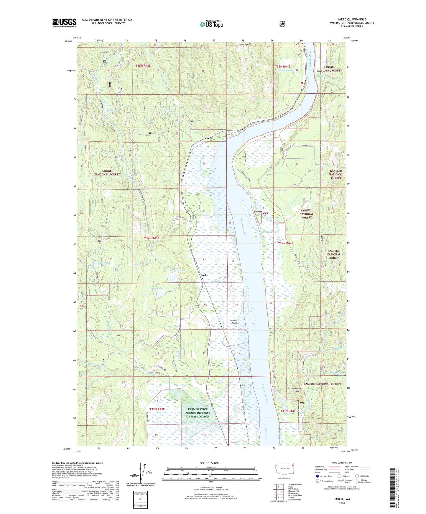
Jared Washington US Topo Map
Couldn't load pickup availability
Also explore the Jared Forest Service Topo of this same quad for updated USFS data
2023 topographic map quadrangle Jared in the state of Washington. Scale: 1:24000. Based on the newly updated USGS 7.5' US Topo map series, this map is in the following counties: Pend Oreille. The map contains contour data, water features, and other items you are used to seeing on USGS maps, but also has updated roads and other features. This is the next generation of topographic maps. Printed on high-quality waterproof paper with UV fade-resistant inks.
Quads adjacent to this one:
West: Tacoma Peak
Northwest: Timber Mountain
North: Ruby
Northeast: North Baldy
East: Browns Lake
Southeast: Skookum Creek
South: Cusick
Southwest: Winchester Peak
This map covers the same area as the classic USGS quad with code o48117d3.
Contains the following named places: Babbitz Lake, Babbitz Landing, Brownie Lake, Browns Creek, Cecil, Cee Cee Ah Creek, Cusick Creek, Farm Service Agency Interest of Washington, Gardiner Creek, Gibraltar Rock, Half Moon Creek, Heater Pond, Heater Pond Dam, Jared, Lake Lucerne, Locke, Locke Dam, Loop Creek, Metcalf Lake, Mill Creek, North Fork South Fork Tacoma Creek, Parker Lake, Pend Oreille Fire District 5, River Bend Airport, Riverside Camp, Ruby Mountain, Silver King Mine, South Fork Tacoma Creek, Sportsman Pond, Sullivan Point, Tacoma Creek, Tacoma Sportsman Pond Dam, Trimble Creek