MyTopo
Browns Lake Washington US Topo Map
Couldn't load pickup availability
Also explore the Browns Lake Forest Service Topo of this same quad for updated USFS data
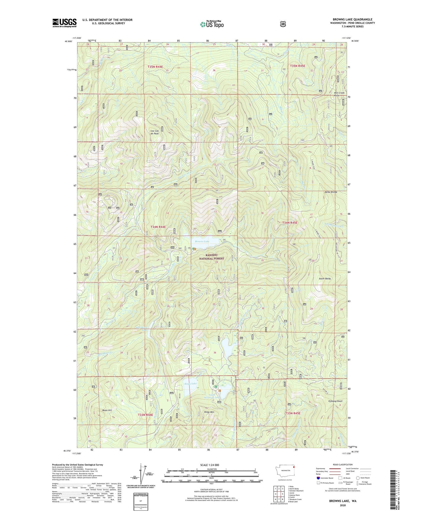
2023 topographic map quadrangle Browns Lake in the state of Washington. Scale: 1:24000. Based on the newly updated USGS 7.5' US Topo map series, this map is in the following counties: Pend Oreille. The map contains contour data, water features, and other items you are used to seeing on USGS maps, but also has updated roads and other features. This is the next generation of topographic maps. Printed on high-quality waterproof paper with UV fade-resistant inks.
Quads adjacent to this one:
West: Jared
Northwest: Ruby
North: North Baldy
Northeast: Gleason Mountain
East: Galena Point
Southeast: Bead Lake
South: Skookum Creek
Southwest: Cusick
This map covers the same area as the classic USGS quad with code o48117d2.
Contains the following named places: Browns Lake, Browns Lake Campground, Browns Lake Recreational Site, Cee Cee Ah Peak, Half Moon Lake, Kings Lake, Kings Mountain, Kings Mountain Lookout, Mill Creek Mountain Lookout, Mill Creek Point, Moon Hill, Moon Hill Lookout, Nola Creek, North Skookum Campground, North Skookum Lake, North Skookum Lake Recreational Site, Ojibway Knoll, Ojibway Knoll Lookout, Pelke Divide, South Baldy, South Baldy Lookout, South Skookum Lake, South Skookum Lake Campground, South Skookum Lake Recreational Site, Split Creek, Sylvis Creek, Vista Lookout