MyTopo
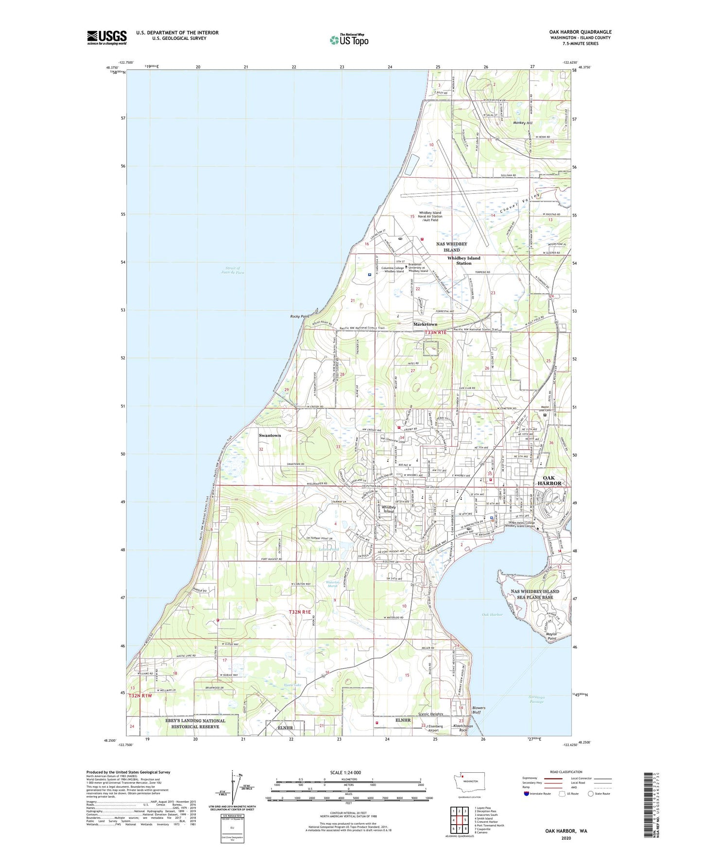
Oak Harbor Washington US Topo Map
Couldn't load pickup availability
2023 topographic map quadrangle Oak Harbor in the state of Washington. Scale: 1:24000. Based on the newly updated USGS 7.5' US Topo map series, this map is in the following counties: Island. The map contains contour data, water features, and other items you are used to seeing on USGS maps, but also has updated roads and other features. This is the next generation of topographic maps. Printed on high-quality waterproof paper with UV fade-resistant inks.
Quads adjacent to this one:
West: Smith Island
Northwest: Lopez Pass
North: Deception Pass
Northeast: Anacortes South
East: Crescent Harbor
Southeast: Camano
South: Coupeville
Southwest: Port Townsend North
This map covers the same area as the classic USGS quad with code o48122c6.
Contains the following named places: AJ Eisenberg Airport, Ault Field Road Sand Quarry, Bible Baptist Church, Bible Baptist Church School, Brandman University at Whidbey Island, Broadview Elementary School, Childrens Academy, Church on the Rock, City of Oak Harbor, Clover Valley Home Connection School, Der Kinderhuis Montessori, Family Bible Church, First Church of Christ Scientist, First Reformed Church, Gallery Golf Course, Grace Evangelical Church, Harbor Tower Village, Harborview Mobile Home Park, Hastie Lake, Hillcrest Elementary School, Homeplace Special Care Center at Oak Harbor, Island County Fire District 2 North Whidbey Fire and Rescue Station 25 Heller Road, Island County Fire District 2 North Whidbey Fire and Rescue Station 26 Zylstra Road, Island County Fire District 2 North Whidbey Fire and Rescue Station 27 Monroe Landing Road, Joseph Whidbey State Park, Kingdom Hall of Jehovahs Witnesses, KJTT-AM (Oak Harbor), Klootchman Rock, Lighthouse Christian Center, Living Word Fellowship Church, Loers Dam, Loers Pond, Maple Leaf Cemetery, Marketown, Maylor Point, Midway School, Monkey Hill, Naval Air Station Whidbey Island, Naval Hospital Oak Harbor, Naval Region Northwest Fire and Rescue Services, New Covenant Fellowship Church, North Whidbey Island Division, North Whidbey Middle School, Oak Harbor, Oak Harbor Assembly of God Church, Oak Harbor Christian Reformed Church, Oak Harbor Christian School, Oak Harbor Church of the Nazarene, Oak Harbor City Hall, Oak Harbor Elementary School, Oak Harbor Fire Department, Oak Harbor Fire Department Headquarters / Station 81, Oak Harbor First United Methodist Church, Oak Harbor High School, Oak Harbor Library, Oak Harbor Lutheran Church, Oak Harbor Marina, Oak Harbor Middle School, Oak Harbor Park and Ride, Oak Harbor Police Department, Oak Harbor Post Office, Oak Harbor School District 201 Office, Oak Harbor Seventh Day Adventist Church, Oak Harbor Sewage Treatment Plant, Oak Harbor Southern Baptist Church, Oak Hollow Mobile Home Park, Olympic View Elementary School, Parkwood Manor Mobile Home Park, Regency on Whidbey, Rocky Point, Rocky Point Picnic Area, Saint Augustine's Catholic Church, Saint Stephen's Anglican Church, Saratoga Heights School, Scenic Heights, Skagit Valley College Whidbey Island Campus, Smith Park, Staysail Recreational Vehicle Park, Summer Hill Assisted Living Community, Swantown, Teddy Bear Child Care Center, The Church of Jesus Christ of Latter Day Saints, Their Place Childrens Center, Valley High Mobile Park, Wagon Wheel Mobile Home Park, Waterloo Marsh, Western Village Mobile Estates, Whidbey Christian Elementary School, Whidbey Golf and Country Club, Whidbey Island, Whidbey Island Campus Hayes Hall, Whidbey Island Campus Oak Hall, Whidbey Island Campus Sprague Hall, Whidbey Island Campus Toddler Learning Center, Whidbey Island Manor, Whidbey Island Naval Air Post Office, Whidbey Island Naval Air Station /Ault Field, Whidbey Island Station Census Designated Place, Whidbey Presbyterian Church, Windmill Mobile Home Courts, YMCA, ZIP Code: 98278


