MyTopo
Smith Island Washington US Topo Map
Couldn't load pickup availability
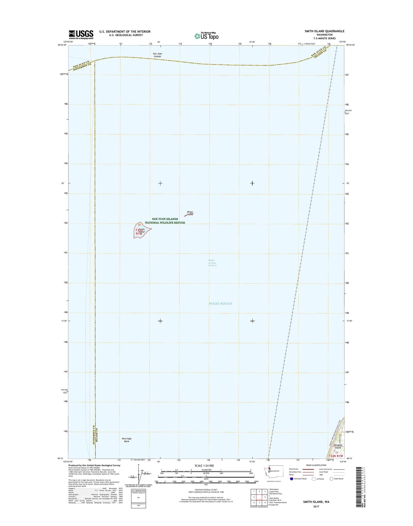
2023 topographic map quadrangle Smith Island in the state of Washington. Scale: 1:24000. Based on the newly updated USGS 7.5' US Topo map series, this map is in the following counties: Island, Jefferson, San Juan. The map contains contour data, water features, and other items you are used to seeing on USGS maps, but also has updated roads and other features. This is the next generation of topographic maps. Printed on high-quality waterproof paper with UV fade-resistant inks.
Quads adjacent to this one:
Northwest: Richardson
North: Lopez Pass
Northeast: Deception Pass
East: Oak Harbor
Southeast: Coupeville
South: Port Townsend North
Southwest: Gardiner OE N
This map covers the same area as the classic USGS quad with code o48122c7.
Contains the following named places: Minor Island, Partridge Bank, Smith Island, Smith Island Lighthouse, Strait of Juan de Fuca