MyTopo
Old Snowy Mountain Washington US Topo Map
Couldn't load pickup availability
Also explore the Old Snowy Mountain Forest Service Topo of this same quad for updated USFS data
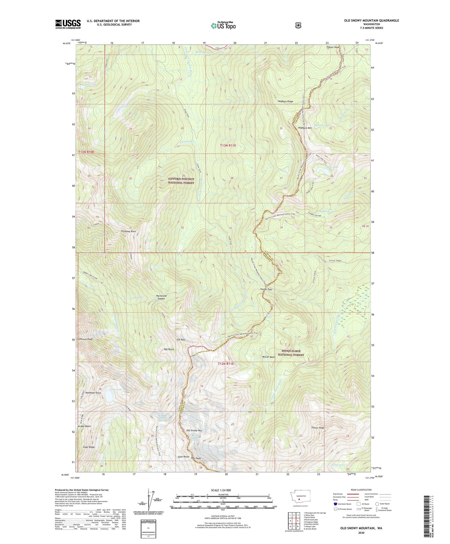
2023 topographic map quadrangle Old Snowy Mountain in the state of Washington. Scale: 1:24000. Based on the newly updated USGS 7.5' US Topo map series, this map is in the following counties: Lewis, Yakima. The map contains contour data, water features, and other items you are used to seeing on USGS maps, but also has updated roads and other features. This is the next generation of topographic maps. Printed on high-quality waterproof paper with UV fade-resistant inks.
Quads adjacent to this one:
West: Packwood Lake
Northwest: Ohanapecosh Hot Springs
North: White Pass
Northeast: Spiral Butte
East: Pinegrass Ridge
Southeast: Jennies Butte
South: Walupt Lake
Southwest: Hamilton Buttes
This map covers the same area as the classic USGS quad with code o46121e4.
Contains the following named places: Chimney Creek, Chimney Rock, Clear Lost Trail, Coyote Creek, Coyote Lake, Coyote Trail, Dana Yelverton Shelter, Egg Butte, Elk Pass, Goat Lake, Goat Ridge, Goat Rocks Wilderness, Hawkeye Point, Hidden Spring, Hogback Mountain, Hogback Ridge, Ives Peak, Lily Basin Trail, Lutz Lake, McCall Basin, McCall Glacier, Miriam Lake, Old Snowy Mountain, Packwood Glacier, Packwood Saddle, Pigtail Peak, Saddle Creek, Shoe Lake, Shoe Lake Trail, Tieton Pass, Tieton Peak