MyTopo
Ozette Washington US Topo Map
Couldn't load pickup availability
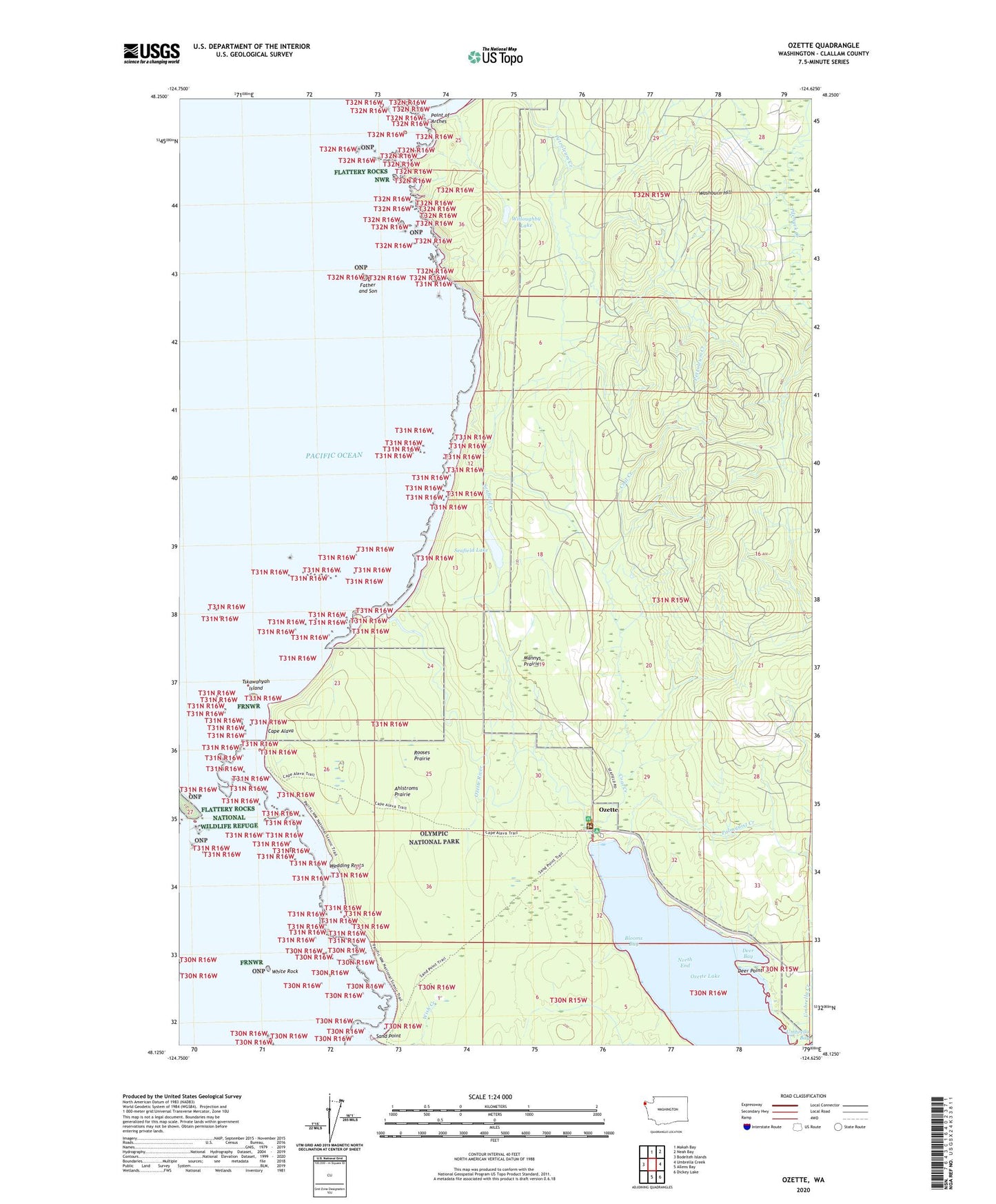
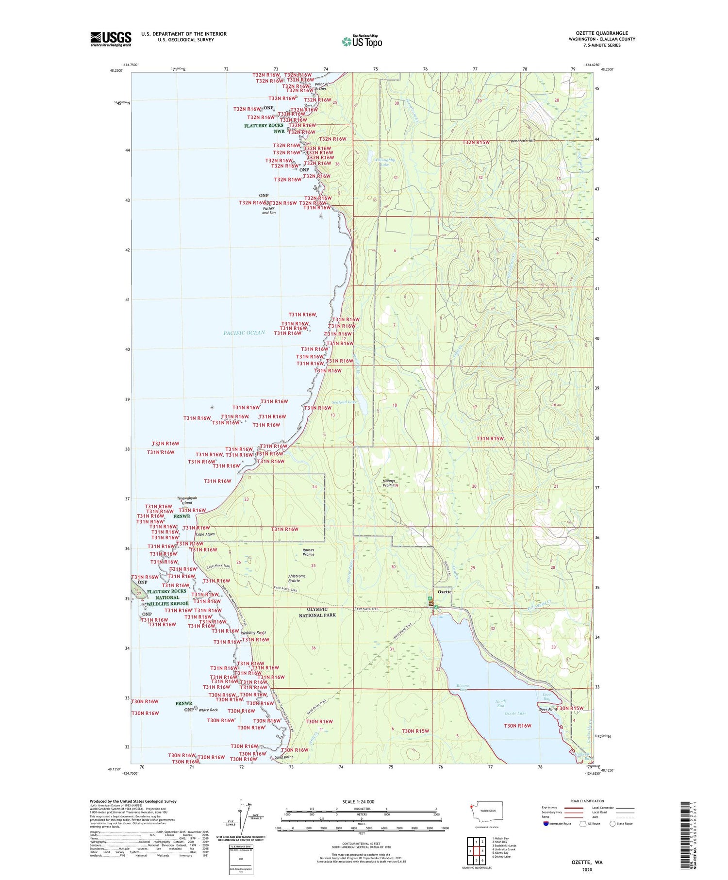
2020 topographic map quadrangle Ozette in the state of Washington. Scale: 1:24000. Based on the newly updated USGS 7.5' US Topo map series, this map is in the following counties: Clallam. The map contains contour data, water features, and other items you are used to seeing on USGS maps, but also has updated roads and other features. This is the next generation of topographic maps. Printed on high-quality waterproof paper with UV fade-resistant inks.
Quads adjacent to this one:
West: Bodelteh Islands
North: Makah Bay
Northeast: Neah Bay
East: Umbrella Creek
Southeast: Dickey Lake
South: Allens Bay
Contains the following named places: Ahlstroms Prairie, Blooms Bay, Boca De Alava, Cape Alava, Coal Creek, Deer Bay, Deer Point, Father and Son, Indian Village, Mannys Prairie, North End, Ozette, Ozette Campground, Ozette Indian Reservation, Ozette Island, Ozette River, Palmquist Creek, Pilchuck Creek, Point of Arches, Rooses Prairie, Sand Point, Seafield Creek, Seafield Lake, Tskawahyah Island, Umbrella Creek, Washburn Hill, Washington Islands Wilderness, Wedding Rocks, White Rock, Willoughby Lake