MyTopo
Pomeroy Washington US Topo Map
Couldn't load pickup availability
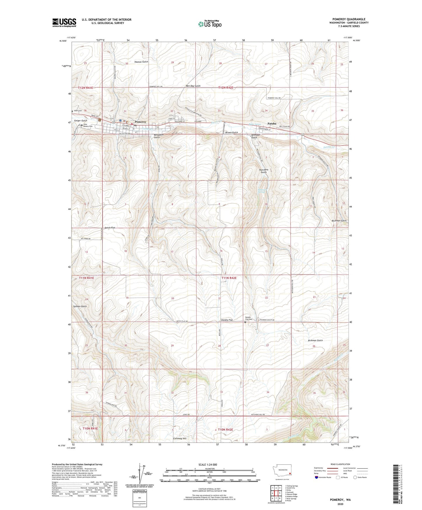
2020 topographic map quadrangle Pomeroy in the state of Washington. Scale: 1:24000. Based on the newly updated USGS 7.5' US Topo map series, this map is in the following counties: Garfield. The map contains contour data, water features, and other items you are used to seeing on USGS maps, but also has updated roads and other features. This is the next generation of topographic maps. Printed on high-quality waterproof paper with UV fade-resistant inks.
Quads adjacent to this one:
West: Zumwalt
Northwest: Falling Springs
North: Gould City
Northeast: Kirby
East: Alpowa Ridge
Southeast: Peola
South: Rose Springs
Southwest: Hopkins Ridge
Contains the following named places: Benjamin Gulch, Berlin, Bihmaier Gulch, Bihmaier Springs, Brown Gulch, Butler Spring, City of Pomeroy, Dutch Flat, Ferrell Field, Garfield County, Garfield County Memorial Hospital, Garfield County Sheriff's Office, Geiger Gulch, Holy Rosary Cemetery, Holy Rosary School, Hutchens Gulch, Pataha, Pataha Census Designated Place, Pataha Flat, Pataha Flat Cemetery, Pomeroy, Pomeroy City Cemetery, Pomeroy Fire Department, Pomeroy Junior Senior High School, Pomeroy Police Department, Pomeroy Post Office, Rickman Gulch, ZIP Code: 99347