MyTopo
Peola Washington US Topo Map
Couldn't load pickup availability
Also explore the Peola Forest Service Topo of this same quad for updated USFS data
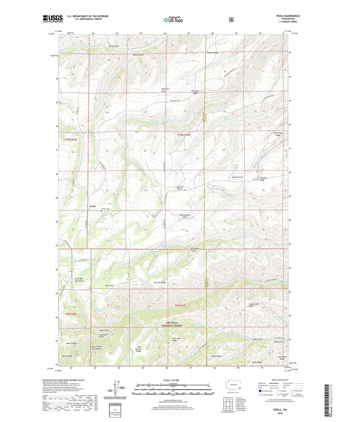
2023 topographic map quadrangle Peola in the state of Washington. Scale: 1:24000. Based on the newly updated USGS 7.5' US Topo map series, this map is in the following counties: Garfield, Asotin. The map contains contour data, water features, and other items you are used to seeing on USGS maps, but also has updated roads and other features. This is the next generation of topographic maps. Printed on high-quality waterproof paper with UV fade-resistant inks.
Quads adjacent to this one:
West: Rose Springs
Northwest: Pomeroy
North: Alpowa Ridge
Northeast: Stember Creek
East: Potter Hill
Southeast: Harlow Ridge
South: Pinkham Butte
Southwest: Stentz Spring
This map covers the same area as the classic USGS quad with code o46117c4.
Contains the following named places: Alder Spring, Bagley Spring, Big Mud Spring, Bill Welch Gulch, Cabin Gulch, Cottonwood Spring, Donaldson Creek, Donaldson Gulch, Dry Fork Lick Creek, Flerchinger Ridge, Flerchinger Spring, Iron Springs, Iron Springs Guard Station, Kidwell Gulch, Knotgrass Ridge, McGilvra Spring, Moonshine Spring, Pataha Research Natural Area, Peola, Peola Pioneer Cemetery, Pleasant Ridge, Robinson Spring, Sheep Gulch, Sheep Gulch Spring, Spring Gulch, Weatherly Spring, Williams Spring, Wolf Spring