MyTopo
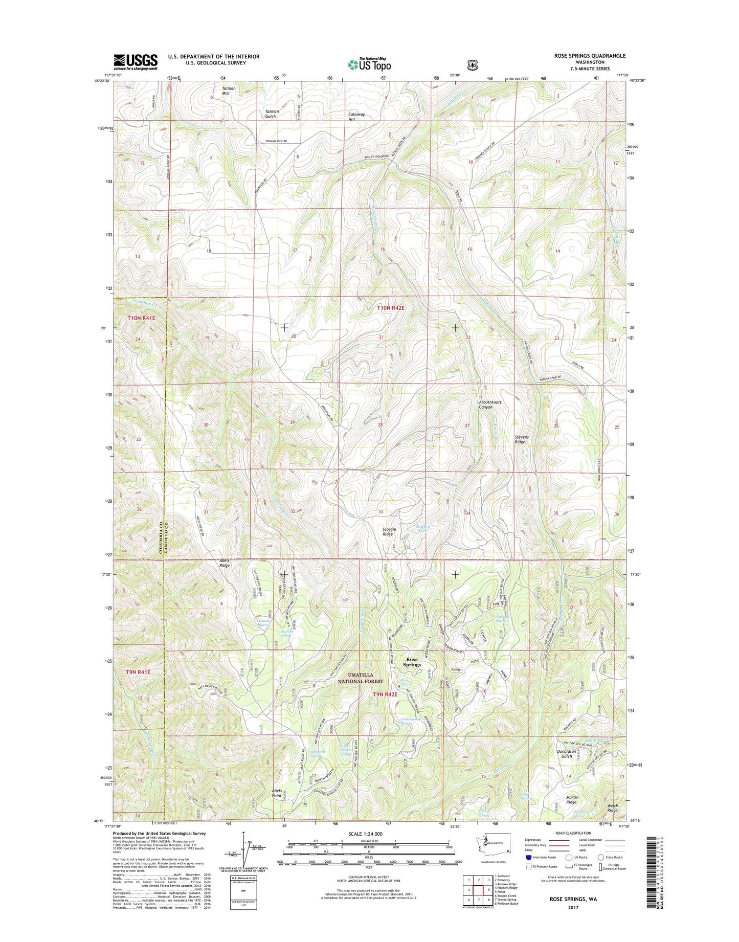
Rose Springs Washington US Topo Map
Couldn't load pickup availability
Also explore the Rose Springs Forest Service Topo of this same quad for updated USFS data
2023 topographic map quadrangle Rose Springs in the state of Washington. Scale: 1:24000. Based on the newly updated USGS 7.5' US Topo map series, this map is in the following counties: Garfield, Columbia. The map contains contour data, water features, and other items you are used to seeing on USGS maps, but also has updated roads and other features. This is the next generation of topographic maps. Printed on high-quality waterproof paper with UV fade-resistant inks.
Quads adjacent to this one:
West: Hopkins Ridge
Northwest: Zumwalt
North: Pomeroy
Northeast: Alpowa Ridge
East: Peola
Southeast: Pinkham Butte
South: Stentz Spring
Southwest: Panjab Creek
This map covers the same area as the classic USGS quad with code o46117c5.
Contains the following named places: Abels Point, Abels Ridge, Alder Thicket Campground, Alder Thicket Spring, Arbothknott Canyon, Baker Pond, Calloway Hill, Cold Spring, Columbia Center, Dry Pataha Creek, Government Spring, Hatten Well, Horseshoe Spring, Lanzie Spring, Martin Ridge, Oliphant Spring, Pataha Campground, Red Hill Gravel Pit, Rose Spring, Rose Springs, Ruchert Spring, Sawmill Spring, Scoggin Ridge, Stevens Ridge, Tatman Mountain, Twin Spring